
Magnitude |
3.4 |
| Date & Time (UTC) | 2025-01-31 14:21:58.1 |
| Date & Time (Local) | 1403/11/12 17:51:58.1 |
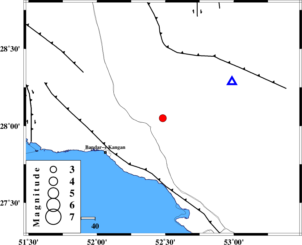
| Location | Lat:28.05 Lon: 52.481 |
| Region | Fars Province, 29 km North-East of Jam |
Nearest Cities |
|
| 22 km East of Dolatabad, Fars Province | |
| 25 km North West of Garmesht, Fars Province | |
| 29 km North East of Jam, Bushehr Province | |
| 39 km South West of Hengam, Fars Province | |
| 40 km North East of Riz, Bushehr Province | |
| Depth | 12 km |
| Agency | |
Faults within 150 km: |
|
| MFF3 (Length: 292 km) , Distance to epicenter: 39 km | |
| QIR_F (Length: 130 km) , Distance to epicenter: 48 km | |
| MFF5 (Length: 74 km) , Distance to epicenter: 66 km | |
| Number of Phases | 8 |
| RMS | 0.3 |
| Number of Stations | 8 |
| Error in Latitude | 1.1 km |
| Error in Longitude | 1.1 km |
| Error in Depth | 2 km |
Download waveform in seisan format
to download seisan software Click here
to access information about IIEES stations Click here
Amplitude
| UID | Agency | Station | Component | Amplitude | Period | Arrival Time | Proccessing Time | Signal Clip |
|---|---|---|---|---|---|---|---|---|
| 199543 | IIEES SC | UOSS | Z | 0.04 | 1 | 2025-01-31 14:23:09 | 2025-10-08 08:47:00 | n |
| 199544 | IIEES SC | YZKH | Z | 0.04 | 1 | 2025-01-31 14:23:11 | 2025-10-08 08:47:00 | n |
| 199545 | IIEES SC | NASN | Z | 0.03 | 1 | 2025-01-31 14:23:11 | 2025-10-08 08:47:00 | n |
| 199546 | IIEES SC | IRSR | Z | 0.006 | 1 | 2025-01-31 14:23:50 | 2025-10-08 08:47:00 | n |
| 199547 | IIEES SC | DAMV | Z | 0.02 | 1 | 2025-01-31 14:23:51 | 2025-10-08 08:47:00 | n |
| 199548 | IIEES SC | RAYN | Z | 0.02 | 1 | 2025-01-31 14:23:52 | 2025-10-08 08:47:00 | n |
Phase
| Agency | Station | Component | Phase Type | Phase Quality | Arrival Time | Time Residual | Loc. Flag | Input Weight | Distance | Azimuth |
|---|---|---|---|---|---|---|---|---|---|---|
| IIEES SC | GHIR | Z | EPg | E | 2025-01-31 14:22:07 | -0.4 | y | 0 | 56 | 62 |
| IIEES SC | KRBR | Z | EPn | E | 2025-01-31 14:23:15 | 11.4 | n | 4 | 469 | 63 |
| IIEES SC | UOSS | Z | EPn | E | 2025-01-31 14:23:09 | 0.2 | y | 0 | 506 | 133 |
| IIEES SC | YZKH | Z | EPn | E | 2025-01-31 14:23:11 | 0.2 | y | 0 | 522 | 23 |
| IIEES SC | NASN | Z | EPn | E | 2025-01-31 14:23:11 | 0 | y | 0 | 527 | 3 |
| IIEES SC | IRSR | Z | EPn | E | 2025-01-31 14:23:50 | 0.1 | y | 0 | 837 | 98 |
| IIEES SC | DAMV | Z | EPn | E | 2025-01-31 14:23:51 | 0.9 | y | 0 | 842 | 357 |
| IIEES SC | RAYN | Z | EPn | E | 2025-01-31 14:23:52 | -0.2 | y | 0 | 861 | 234 |