
Magnitude |
3.2 |
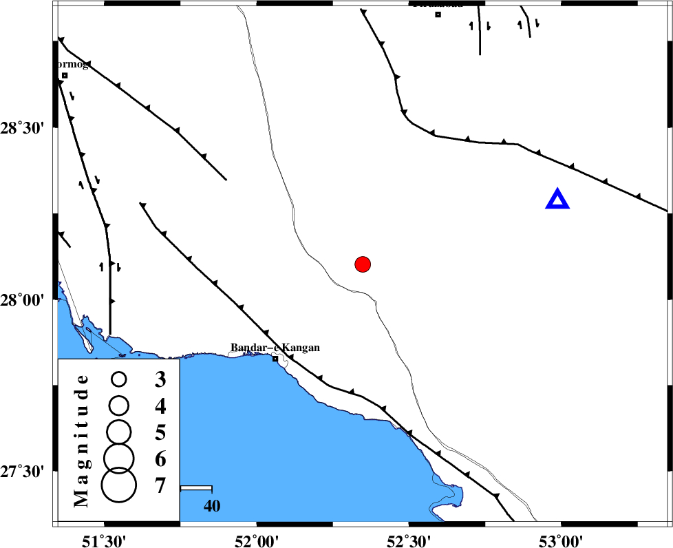
| Date & Time (UTC) | 2025-01-31 19:27:52.2 |
| Date & Time (Local) | 1403/11/12 22:57:52.2 |
| Location | Lat:28.102 Lon: 52.348 |
| Region | Fars Province, 30 km North of Jam |
Nearest Cities |
|
| 8 km of Dolatabad, Fars Province | |
| 28 km North East of Riz, Bushehr Province | |
| 30 km North of Jam, Bushehr Province | |
| 39 km North West of Garmesht, Fars Province | |
| 42 km North East of Bandar-e kangan, Bushehr Province | |
| Depth | 12 km |
| Agency | |
Faults within 150 km: |
|
| MFF3 (Length: 292 km) , Distance to epicenter: 38 km | |
| QIR_F (Length: 130 km) , Distance to epicenter: 48 km | |
| MFF5 (Length: 74 km) , Distance to epicenter: 52 km | |
| Number of Phases | 9 |
| RMS | 0.4 |
| Number of Stations | 9 |
| Error in Latitude | 2.3 km |
| Error in Longitude | 2.3 km |
| Error in Depth | 12.9 km |
Download waveform in seisan format
to download seisan software Click here
to access information about IIEES stations Click here
Amplitude
| UID | Agency | Station | Component | Amplitude | Period | Arrival Time | Proccessing Time | Signal Clip |
|---|---|---|---|---|---|---|---|---|
| 199641 | IIEES SC | UOSS | Z | 0.02 | 1 | 2025-01-31 19:29:04 | 2025-10-15 11:26:00 | n |
| 199642 | IIEES SC | YZKH | Z | 0.02 | 1 | 2025-01-31 19:29:06 | 2025-10-15 11:26:00 | n |
| 199643 | IIEES SC | IRSR | Z | 0.006 | 1 | 2025-01-31 19:29:45 | 2025-10-15 11:26:00 | n |
Phase
| Agency | Station | Component | Phase Type | Phase Quality | Arrival Time | Time Residual | Loc. Flag | Input Weight | Distance | Azimuth |
|---|---|---|---|---|---|---|---|---|---|---|
| IIEES SC | GHIR | Z | EPg | E | 2025-01-31 19:28:03 | -0.2 | y | 0 | 66 | 72 |
| IIEES SC | KRBR | Z | EPn | E | 2025-01-31 19:29:10 | 11.2 | n | 4 | 478 | 64 |
| IIEES SC | UOSS | Z | EPn | E | 2025-01-31 19:29:04 | 0.2 | y | 0 | 520 | 132 |
| IIEES SC | YZKH | Z | EPn | E | 2025-01-31 19:29:06 | 0.8 | y | 0 | 522 | 24 |
| IIEES SC | NASN | Z | EPn | E | 2025-01-31 19:29:04 | -0.7 | y | 0 | 523 | 5 |
| IIEES SC | TABS | Z | EPn | E | 2025-01-31 19:29:35 | 0.1 | y | 0 | 766 | 37 |
| IIEES SC | IRSR | Z | EPn | E | 2025-01-31 19:29:45 | -0.4 | y | 0 | 850 | 98 |
| IIEES SC | RAYN | Z | EPn | E | 2025-01-31 19:29:45 | -0.3 | y | 0 | 854 | 234 |
| IIEES SC | SRSL | Z | EPn | E | 2025-01-31 19:30:18 | 0.5 | y | 0 | 1111 | 324 |