
Magnitude |
3.4 |
| Date & Time (UTC) | 2025-01-13 08:39:51.3 |
| Date & Time (Local) | 1403/10/24 12:09:51.3 |
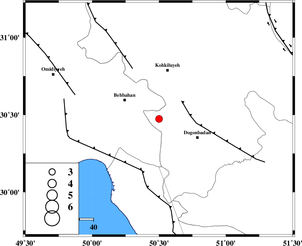
| Location | Lat:30.474 Lon: 50.5 |
| Region | Kohkiluieh va boyerahmad Province, 35 km South of Dehdasht |
Nearest Cities |
|
| 26 km South East of Mansuriyeh, Khoozestan Province | |
| 28 km South East of Behbahan, Khoozestan Province | |
| 31 km North West of Dogonbadan, Kohkiluieh va boyerahmad Province | |
| 32 km North East of Sardasht, Khoozestan Province | |
| 35 km South of Dehdasht, Kohkiluieh va boyerahmad Province | |
| Depth | 12 km |
| Agency | |
Faults within 150 km: |
|
| MISHAN_F (Length: 76 km) , Distance to epicenter: 21 km | |
| ZFF3 (Length: 125 km) , Distance to epicenter: 39 km | |
| RAG_E_SEFID_F (Length: 84 km) , Distance to epicenter: 39 km | |
| Number of Phases | 8 |
| RMS | 0.5 |
| Number of Stations | 8 |
| Error in Latitude | 2.9 km |
| Error in Longitude | 2.9 km |
| Error in Depth | 658.6 km |
Download waveform in seisan format
to download seisan software Click here
to access information about IIEES stations Click here
Amplitude
| UID | Agency | Station | Component | Amplitude | Period | Arrival Time | Proccessing Time | Signal Clip |
|---|---|---|---|---|---|---|---|---|
| 199785 | IIEES SC | ANAR | Z | 0.03 | 1 | 2025-01-13 08:40:52 | 2025-10-21 08:18:00 | n |
| 199786 | IIEES SC | KRBR | Z | 0.03 | 1 | 2025-01-13 08:41:14 | 2025-10-21 08:18:00 | n |
| 199787 | IIEES SC | DHR | Z | 0.05 | 1 | 2025-01-13 08:41:14 | 2025-10-21 08:18:00 | n |
Phase
| Agency | Station | Component | Phase Type | Phase Quality | Arrival Time | Time Residual | Loc. Flag | Input Weight | Distance | Azimuth |
|---|---|---|---|---|---|---|---|---|---|---|
| IIEES SC | KLNJ | Z | EPg | E | 2025-01-13 08:40:04 | -7.4 | n | 4 | 120 | 60 |
| IIEES SC | ANAR | Z | EPn | E | 2025-01-13 08:40:52 | -0.4 | y | 0 | 429 | 45 |
| IIEES SC | LMD1 | Z | EPn | E | 2025-01-13 08:40:53 | 0.7 | y | 0 | 434 | 143 |
| IIEES SC | KRBR | Z | EPn | E | 2025-01-13 08:41:14 | 0.1 | y | 0 | 605 | 95 |
| IIEES SC | DHR | Z | EPn | E | 2025-01-13 08:41:14 | 0 | y | 0 | 607 | 321 |
| IIEES SC | GLO | Z | EPn | E | 2025-01-13 08:41:31 | 0.9 | y | 0 | 737 | 25 |
| IIEES SC | UOSS | Z | EPn | E | 2025-01-13 08:41:42 | -0.3 | y | 0 | 832 | 137 |
| IIEES SC | RAYN | Z | EPn | E | 2025-01-13 08:41:52 | -0.5 | y | 0 | 916 | 213 |