
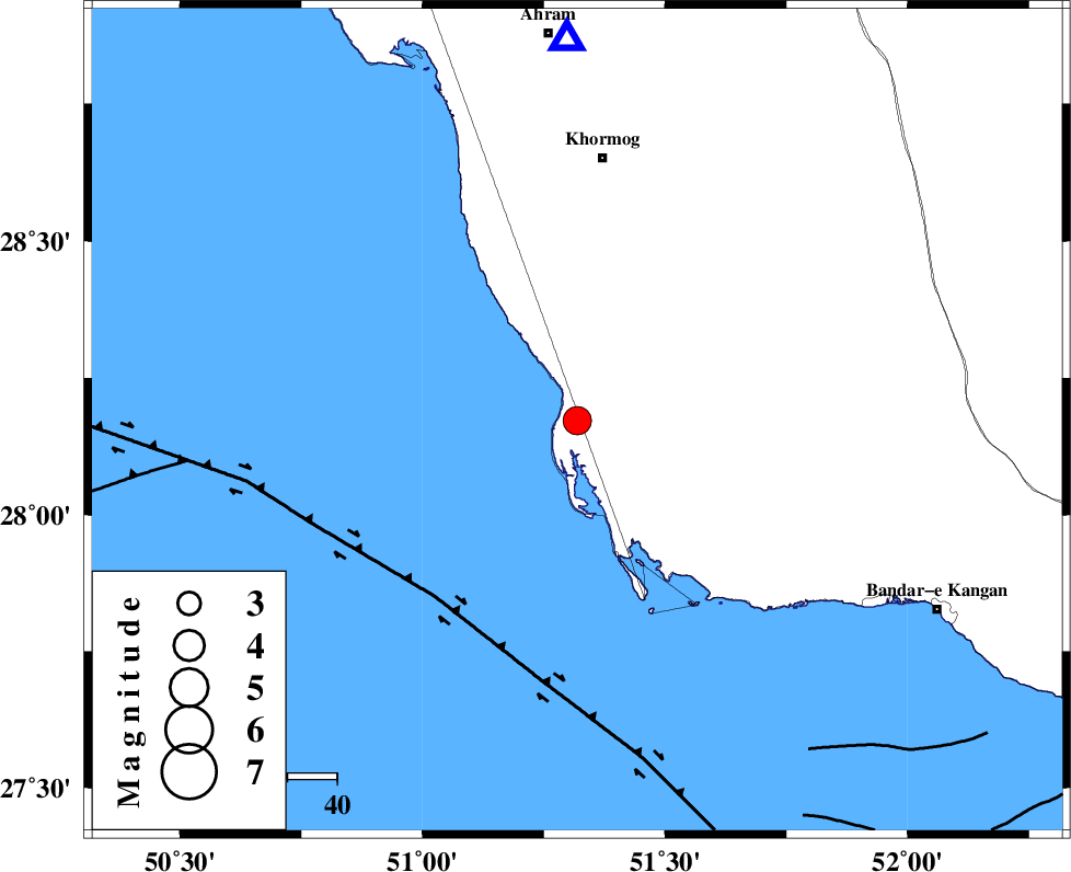
Magnitude |
3.7 |
| Date & Time (UTC) | 2025-12-01 15:11:45.6 |
| Date & Time (Local) | 1404/9/10 18:41:45.6 |
| Location | Lat:28.172 Lon: 51.319 |
| Region | Bushehr Province, 54 km South of Khormog |
Nearest Cities |
|
| 5 km North of Ziyarat, Bushehr Province | |
| 20 km North West of Bardkhun, Bushehr Province | |
| 20 km North West of Abkesh, Bushehr Province | |
| 27 km South West of Kaki, Bushehr Province | |
| 30 km South West of Baduleh, Bushehr Province | |
| Depth | 12 km |
| Agency | |
Faults within 150 km: |
|
| ZFF2 (Length: 84 km) , Distance to epicenter: 7 km | |
| BORAZJAN_F (Length: 168 km) , Distance to epicenter: 19 km | |
| MFF3 (Length: 292 km) , Distance to epicenter: 32 km | |
| Number of Phases | 9 |
| RMS | 0.5 |
| Number of Stations | 9 |
| Error in Latitude | 4.5 km |
| Error in Longitude | 4.5 km |
| Error in Depth | 11.3 km |
Download waveform in seisan format
to download seisan software Click here
to access information about IIEES stations Click here
Amplitude
| UID | Agency | Station | Component | Amplitude | Period | Arrival Time | Proccessing Time | Signal Clip |
|---|---|---|---|---|---|---|---|---|
| 200458 | IIEES SC | YZKH | Z | 0.09 | 1 | 2025-12-01 15:13:03 | 2025-12-06 07:22:00 | n |
| 200459 | IIEES SC | UOSS | Z | 0.03 | 1 | 2025-12-01 15:13:08 | 2025-12-06 07:22:00 | n |
| 200460 | IIEES SC | TABS | Z | 0.02 | 1 | 2025-12-01 15:13:35 | 2025-12-06 07:22:00 | n |
| 200461 | IIEES SC | BSRN | Z | 0.01 | 1 | 2025-12-01 15:13:39 | 2025-12-06 07:22:00 | n |
Phase
| Agency | Station | Component | Phase Type | Phase Quality | Arrival Time | Time Residual | Loc. Flag | Input Weight | Distance | Azimuth |
|---|---|---|---|---|---|---|---|---|---|---|
| IIEES SC | GHIR | Z | EPg | E | 2025-12-01 15:12:13 | 0.8 | y | 0 | 164 | 86 |
| IIEES SC | NASN | Z | EPn | E | 2025-12-01 15:13:00 | 0.1 | y | 0 | 532 | 16 |
| IIEES SC | YZKH | Z | EPn | E | 2025-12-01 15:13:03 | -0.7 | y | 0 | 564 | 34 |
| IIEES SC | UOSS | Z | EPn | E | 2025-12-01 15:13:08 | -0.2 | y | 0 | 604 | 126 |
| IIEES SC | GHVR | Z | EPn | E | 2025-12-01 15:13:20 | 0.5 | y | 0 | 699 | 359 |
| IIEES SC | TABS | Z | EPn | E | 2025-12-01 15:13:35 | 0.2 | y | 0 | 822 | 42 |
| IIEES SC | BSRN | Z | EPn | E | 2025-12-01 15:13:39 | -1 | y | 0 | 862 | 61 |
| IIEES SC | ZHSF | Z | EPn | E | 2025-12-01 15:13:49 | 0.1 | y | 0 | 935 | 80 |
| IIEES SC | IRSR | Z | EPn | E | 2025-12-01 15:13:51 | -0.5 | y | 0 | 952 | 98 |