
Magnitude |
3.2 |
| Date & Time (UTC) | 2026-01-18 09:57:45.1 |
| Date & Time (Local) | 1404/10/28 13:27:45.1 |
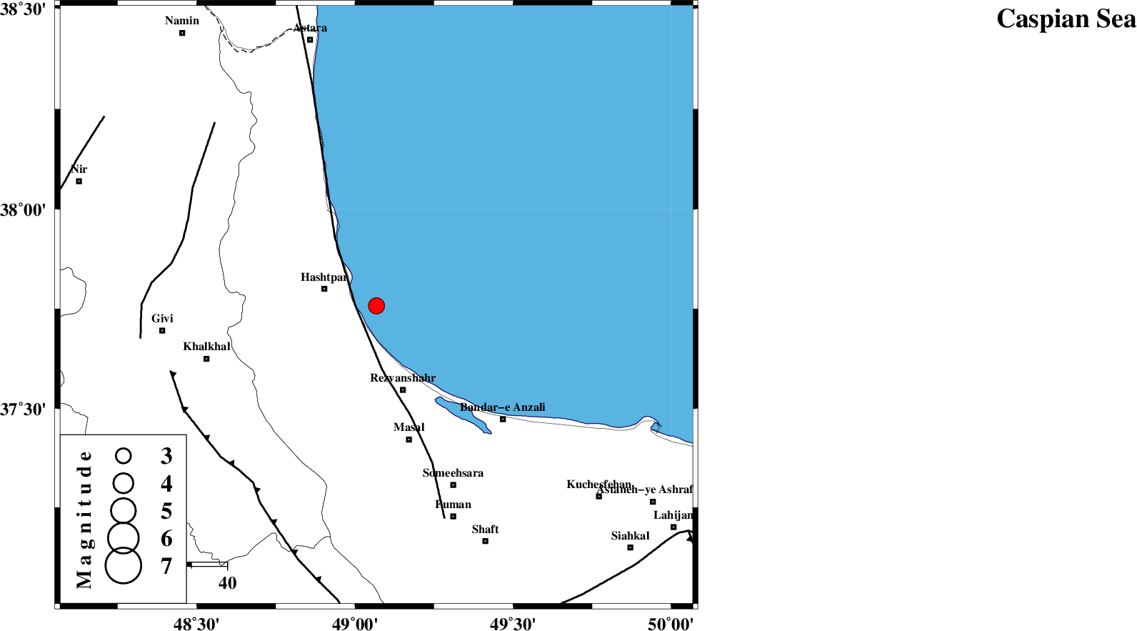
| Location | Lat:37.757 Lon: 49.068 |
| Region | Caspian Sea, 15 km -East of Hashtpar |
Nearest Cities |
|
| 12 km North East of Tularud, Gilan Province | |
| 14 km East of Hashtpar, Gilan Province | |
| 15 km East of Hashtpar, Gilan Province | |
| 16 km North of Void, Gilan Province | |
| 17 km East of Chelonasr, Gilan Province | |
| Depth | 16 km |
| Agency | |
Faults within 150 km: |
|
| TALESH_F (Length: 258 km) , Distance to epicenter: 6 km | |
| SANGAVAR_F (Length: 61 km) , Distance to epicenter: 57 km | |
| MASULEL_F (Length: 90 km) , Distance to epicenter: 60 km | |
| Number of Phases | 8 |
| RMS | 0.5 |
| Number of Stations | 8 |
| Error in Latitude | 5.3 km |
| Error in Longitude | 5.3 km |
| Error in Depth | 13.6 km |
Download waveform in seisan format
to download seisan software Click here
to access information about IIEES stations Click here
Amplitude
| UID | Agency | Station | Component | Amplitude | Period | Arrival Time | Proccessing Time | Signal Clip |
|---|---|---|---|---|---|---|---|---|
| 201154 | IIEES SC | SFB | Z | 0.03 | 1 | 2026-01-18 09:58:50 | 2026-01-19 07:38:00 | n |
| 201155 | IIEES SC | ABGH | Z | 0.03 | 1 | 2026-01-18 09:58:58 | 2026-01-19 07:38:00 | n |
| 201156 | IIEES SC | BJRD | Z | 0.008 | 1 | 2026-01-18 09:59:23 | 2026-01-19 07:38:00 | n |
Phase
| Agency | Station | Component | Phase Type | Phase Quality | Arrival Time | Time Residual | Loc. Flag | Input Weight | Distance | Azimuth |
|---|---|---|---|---|---|---|---|---|---|---|
| IIEES SC | GIDE | Z | EPg | E | 2026-01-18 09:58:04 | 0.2 | y | 0 | 114 | 144 |
| IIEES SC | SRSL | Z | EPn | E | 2026-01-18 09:58:37 | -0.3 | y | 0 | 366 | 242 |
| IIEES SC | ASAO | Z | EPn | E | 2026-01-18 09:58:37 | -0.4 | y | 0 | 366 | 166 |
| IIEES SC | HNVD | Z | EPn | E | 2026-01-18 09:58:41 | 0.6 | y | 0 | 389 | 191 |
| IIEES SC | DOB | Z | EPn | E | 2026-01-18 09:58:48 | 0.3 | y | 0 | 448 | 190 |
| IIEES SC | SFB | Z | EPn | E | 2026-01-18 09:58:50 | -0.7 | y | 0 | 474 | 143 |
| IIEES SC | ABGH | Z | EPn | E | 2026-01-18 09:58:58 | 0.7 | y | 0 | 521 | 103 |
| IIEES SC | BJRD | Z | EPn | E | 2026-01-18 09:59:23 | -0.5 | y | 0 | 736 | 90 |