
Magnitude |
2.8 |
| Date & Time (UTC) | 2009-05-16 19:51:55.5 |
| Date & Time (Local) | 1388/2/27 00:21:55.5 |
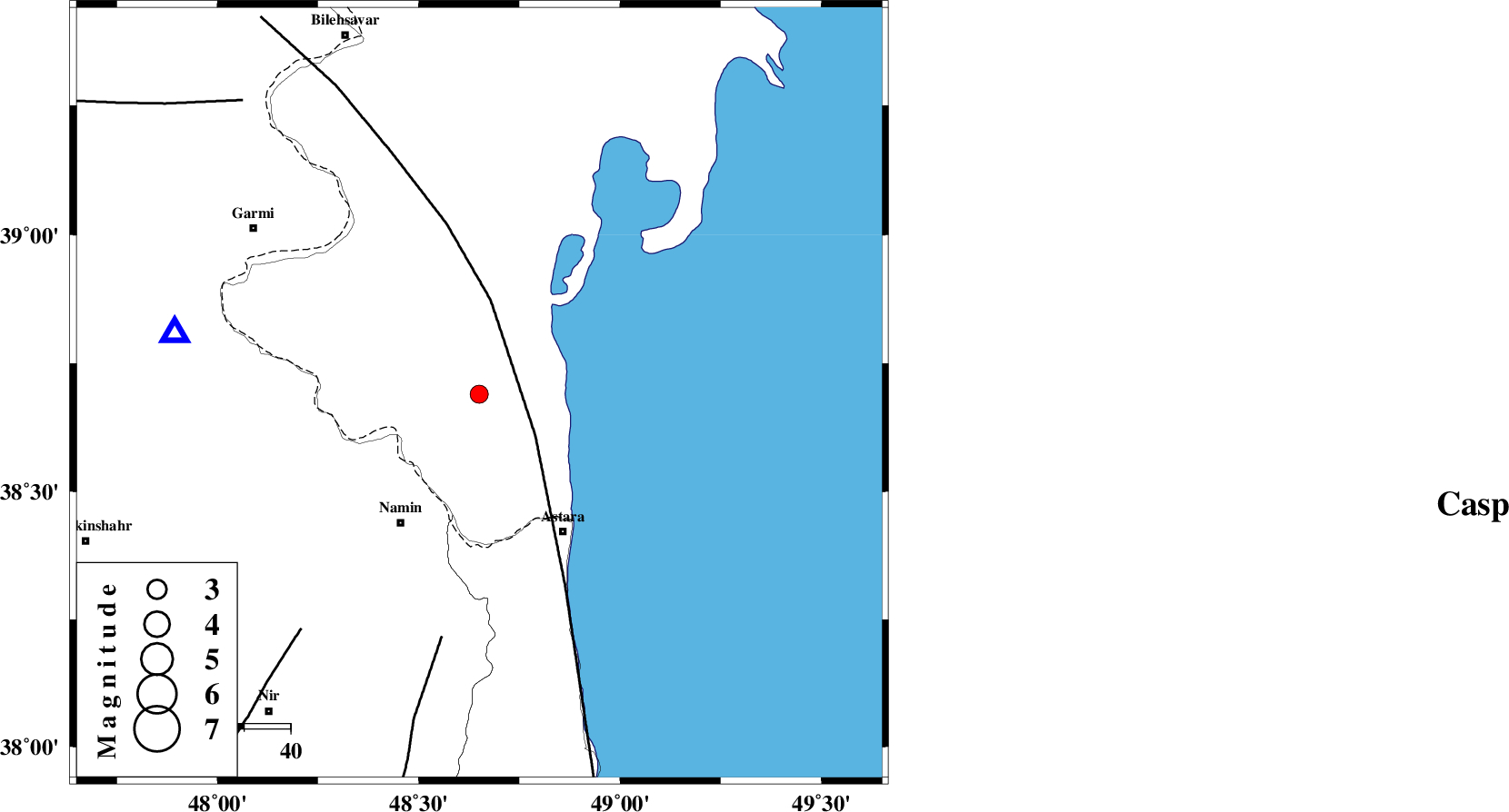
| Location | Lat:38.69 Lon: 48.65 |
| Region | 32 km North-East of Namin, Ardebil Province |
Nearest Cities |
|
| 27 km North East of Anbaran, Ardebil Province | |
| 29 km North East of Lurun, Ardebil Province | |
| 32 km North East of Khaneh zeinian, Ardebil Province | |
| 33 km North East of Namin, Ardebil Province | |
| 34 km North of Kiladeh, Gilan Province | |
| Depth | 20 km |
| Agency | |
Faults within 150 km: |
|
| TALESH_F (Length: 258 km) , Distance to epicenter: 15 km | |
| SANGAVAR_F (Length: 61 km) , Distance to epicenter: 53 km | |
| BOZQUSH (Length: 70 km) , Distance to epicenter: 64 km | |
| Number of Phases | 6 |
| RMS | 0.1 |
| Number of Stations | 6 |
| Error in Latitude | 4.5 km |
| Error in Longitude | 4.6 km |
| Error in Depth | 5.5 km |
Download waveform in seisan format
to download seisan software Click here
to access information about IIEES stations Click here
Amplitude
| UID | Agency | Station | Component | Amplitude | Period | Arrival Time | Proccessing Time | Signal Clip |
|---|---|---|---|---|---|---|---|---|
| 52746 | IIEES | GRMI | E | 865.8 | 0.28 | 2009-05-16 19:52:16 | 2009-07-13 01:52:00 | n |
| 52747 | IIEES | ZNJK | N | 33.7 | 0.4 | 2009-05-16 19:53:01 | 2009-07-13 01:52:00 | n |
| 52748 | IIEES | ZNJK | E | 59.6 | 0.44 | 2009-05-16 19:53:01 | 2009-07-13 01:52:00 | n |
| 52749 | IIEES | MAKU | E | 19.6 | 0.4 | 2009-05-16 19:53:36 | 2009-07-13 01:52:00 | n |
| 52750 | IIEES | MAKU | N | 24.7 | 0.44 | 2009-05-16 19:53:36 | 2009-07-13 01:52:00 | n |
| 52751 | IIEES | THKV | E | 50.7 | 0.36 | 2009-05-16 19:53:29 | 2009-07-13 01:52:00 | n |
| 52752 | IIEES | THKV | N | 44 | 0.32 | 2009-05-16 19:53:30 | 2009-07-13 01:52:00 | n |
Phase
| Agency | Station | Component | Phase Type | Phase Quality | Arrival Time | Time Residual | Loc. Flag | Input Weight | Distance | Azimuth |
|---|---|---|---|---|---|---|---|---|---|---|
| IIEES | GRMI | Z | Pg | E | 2009-05-16 19:52:07 | 0 | y | 66.8 | 282 | |
| IIEES | ZNJK | Z | Pn | E | 2009-05-16 19:52:30 | -0.1 | y | 224 | 179 | |
| IIEES | MAKU | Z | Pn | E | 2009-05-16 19:52:46 | 0 | y | 351 | 283 | |
| IIEES | THKV | Z | Pn | E | 2009-05-16 19:52:48 | 0.1 | y | 365 | 147 | |
| IIEES | CHTH | Z | Pn | E | 2009-05-16 19:52:49 | -0.1 | y | 379 | 144 | |
| IIEES | SNGE | Z | Pn | E | 2009-05-16 19:52:54 | 0.1 | y | 415 | 197 |