Magnitude |
:3.2 |
| Date & Time (UTC) | 2020-10-02 07:09:19.5 |
| Date & Time (Local) | 1399/7/11 10:39:19.5 |
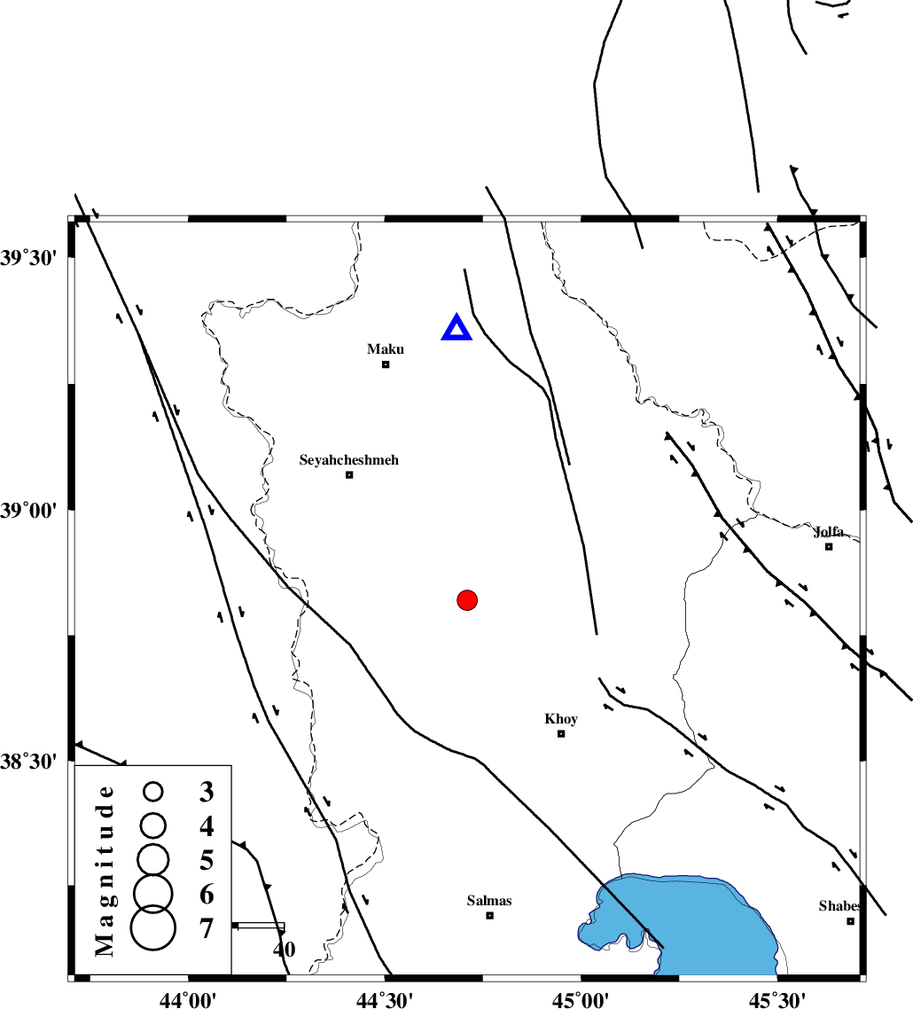
| Location | Lat:38.82 Lon: 44.71 |
| Region | Azarbaijan Gharbi Province, 36 km North-West of Khoy |
Nearest Cities |
|
| 14 km North East of Zarabad, Azarbaijan Gharbi Province | |
| 22 km South of Qarantu, Azarbaijan Gharbi Province | |
| 22 km West of Bastam, Azarbaijan Gharbi Province | |
| 28 km North East of Baleh sur-e sofla, Azarbaijan Gharbi Province | |
| 29 km North West of Dizaj, Azarbaijan Gharbi Province | |
| Depth | 10 km |
| Agency | |
Faults within 150 km: |
|
| KHOY (Length: 100 km) , Distance to epicenter: 4 km | |
| N_TABRIZ_F3 (Length: 66 km) , Distance to epicenter: 59 km | |
| SALMAS (Length: 20 km) , Distance to epicenter: 67 km | |
| Number of Phases | 6 |
| RMS | 0.5 |
| Number of Stations | 7 |
| Error in Latitude | >4 km |
| Error in Longitude | 0 km |
| Error in Depth | 6 km |
Download waveform in seisan format
to download seisan software Click here
to access information about IIEES stations Click here
Amplitude | ||||||||
| UID | Agency | Station | Component | Amplitude | Period | Arrival Time | Proccessing Time | Signal Clip |
| 158173 | IIEES SC | MRD | Z | 1900 | 1 | 2020-10-02 07:09:50 | 2020-10-03 12:46:00 | n |
| 158174 | IIEES SC | AZR | Z | 970 | 1 | 2020-10-02 07:10:19 | 2020-10-03 12:46:00 | n |
| 158175 | IIEES SC | MAHB | Z | 51 | 1 | 2020-10-02 07:10:44 | 2020-10-03 12:46:00 | n |
| 158176 | IIEES SC | GRMI | Z | 63 | 1 | 2020-10-02 07:10:40 | 2020-10-03 12:46:00 | n |
| 158177 | IIEES SC | SRSL | Z | 30 | 1 | 2020-10-02 07:10:58 | 2020-10-03 12:46:00 | n |
Phase | ||||||||||||
| Agency | Station | Component | Phase Type | Phase Quality | First Motion | Observed Arrival Time | Time Residual | Loc. Flag | Input Weight | Distance | Azimuth | |
| IIEES SC | MAKU | E | IP | I | 2020-10-02 07:09:30 | -0.3 | y | 55 | 358 | |||
| IIEES SC | MRD | Z | IP | I | 2020-10-02 07:09:34 | -0.5 | y | 88 | 98 | |||
| IIEES SC | AZR | Z | IP | I | 2020-10-02 07:09:47 | -0.4 | y | 166 | 139 | |||
| IIEES SC | MAHB | Z | IP | I | 2020-10-02 07:09:57 | -0.6 | y | 244 | 159 | |||
| IIEES SC | GRMI | Z | IP | I | 2020-10-02 07:10:03 | 0.9 | y | 278 | 90 | |||
| IIEES SC | SRSL | Z | IP | I | 2020-10-02 07:10:05 | 1 | y | 300 | 168 | |||