Magnitude |
:3.3 |
| Date & Time (UTC) | 2021-08-16 01:47:39.5 |
| Date & Time (Local) | 1400/5/25 06:17:39.5 |
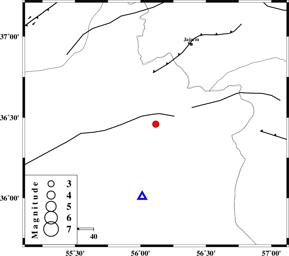
| Location | Lat:36.459 Lon: 56.116 |
| Region | Semnan Province, 60 km South-West of Jajarm |
Nearest Cities |
|
| 42 km North East of Miamay, Semnan Province | |
| 50 km North East of Khankhodi, Semnan Province | |
| 50 km North East of Biarjomand, Semnan Province | |
| 57 km West of Frumad, Semnan Province | |
| 60 km South West of Jajarm, Khorasan(north) Province | |
| Depth | 14 km |
| Agency | |
Faults within 150 km: |
|
| MEYAMEY_F (Length: 141 km) , Distance to epicenter: 7 km | |
| JOGHATAI_F (Length: 70 km) , Distance to epicenter: 27 km | |
| JAJARAM_F (Length: 77 km) , Distance to epicenter: 35 km | |
| Number of Phases | 7 |
| RMS | 0.1 |
| Number of Stations | 7 |
| Error in Latitude | >0.8 km |
| Error in Longitude | 0.8 km |
| Error in Depth | 2.4 km |
Download waveform in seisan format
to download seisan software Click here
to access information about IIEES stations Click here
Amplitude | ||||||||
| UID | Agency | Station | Component | Amplitude | Period | Arrival Time | Proccessing Time | Signal Clip |
| 164954 | IIEES SC | MRVT | Z | 0.8 | 1 | 2021-08-16 01:48:01 | 2021-08-24 07:21:00 | n |
| 164955 | IIEES SC | ANJ | Z | 0.2 | 1 | 2021-08-16 01:48:15 | 2021-08-24 07:21:00 | n |
| 164956 | IIEES SC | TABS | Z | 0.2 | 1 | 2021-08-16 01:48:27 | 2021-08-24 07:21:00 | n |
| 164957 | IIEES SC | YZKH | Z | 0.08 | 1 | 2021-08-16 01:48:45 | 2021-08-24 07:21:00 | n |
Phase | ||||||||||||
| Agency | Station | Component | Phase Type | Phase Quality | First Motion | Observed Arrival Time | Time Residual | Loc. Flag | Input Weight | Distance | Azimuth | |
| IIEES SC | SHRO | Z | EPg | E | 2021-08-16 01:47:48 | 0 | y | 0 | 51 | 190 | ||
| IIEES SC | ABGH | Z | EPg | E | 2021-08-16 01:47:59 | 0 | y | 0 | 122 | 285 | ||
| IIEES SC | MRVT | Z | EPg | E | 2021-08-16 01:48:01 | -0.1 | y | 0 | 133 | 359 | ||
| IIEES SC | GLO | Z | EPn | E | 2021-08-16 01:48:12 | 0.2 | y | 0 | 205 | 271 | ||
| IIEES SC | ANJ | Z | EPn | E | 2021-08-16 01:48:15 | -0.2 | y | 0 | 227 | 241 | ||
| IIEES SC | TABS | Z | EPn | E | 2021-08-16 01:48:27 | 0.1 | y | 0 | 325 | 164 | ||
| IIEES SC | YZKH | Z | EPn | E | 2021-08-16 01:48:45 | -0.2 | y | 0 | 473 | 197 | ||