Magnitude |
:3.4 |
| Date & Time (UTC) | 2023-02-06 11:36:22.0 |
| Date & Time (Local) | 1401/11/17 15:06:22.0 |
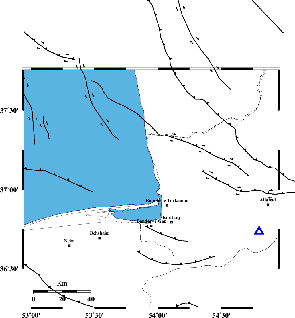
| Location | Lat:37.005 Lon: 53.946 |
| Region | Caspian Sea, 16 km North-West of Bandar-e torkaman |
Nearest Cities |
|
| 16 km West of Gomishtappeh, Golestan Province | |
| 16 km North West of Bandar-e torkaman, Golestan Province | |
| 20 km North West of Sijval, Golestan Province | |
| 25 km West of Banavar, Golestan Province | |
| 26 km North of Bandar-e gaz, Golestan Province | |
| Depth | 12 km |
| Agency | |
Faults within 150 km: |
|
| KHAZAR_F (Length: 523 km) , Distance to epicenter: 29 km | |
| N_ALBORZ_F (Length: 360 km) , Distance to epicenter: 56 km | |
| SHAVAR_F (Length: 87 km) , Distance to epicenter: 64 km | |
| Number of Phases | 9 |
| RMS | 0.5 |
| Number of Stations | 9 |
| Error in Latitude | >4 km |
| Error in Longitude | 4 km |
| Error in Depth | 6 km |
Download waveform in seisan format
to download seisan software Click here
to access information about IIEES stations Click here
Amplitude | ||||||||
| UID | Agency | Station | Component | Amplitude | Period | Arrival Time | Proccessing Time | Signal Clip |
| 178757 | IIEES SC | SHRO | Z | 0.4 | 1 | 2023-02-06 11:36:56 | 2023-02-07 05:36:00 | n |
| 178758 | IIEES SC | CHTH | Z | 0.4 | 1 | 2023-02-06 11:37:05 | 2023-02-07 05:36:00 | n |
| 178759 | IIEES SC | BJRD | Z | 0.2 | 1 | 2023-02-06 11:37:09 | 2023-02-07 05:36:00 | n |
Phase | ||||||||||||
| Agency | Station | Component | Phase Type | Phase Quality | First Motion | Observed Arrival Time | Time Residual | Loc. Flag | Input Weight | Distance | Azimuth | |
| IIEES SC | GLO | Z | EPg | E | 2023-02-06 11:36:31 | -0.3 | y | 0 | 57 | 190 | ||
| IIEES SC | ABGH | Z | EPg | E | 2023-02-06 11:36:37 | 1 | y | 0 | 82 | 112 | ||
| IIEES SC | ANJ | Z | EPg | E | 2023-02-06 11:36:50 | 0.4 | y | 0 | 171 | 181 | ||
| IIEES SC | MRVT | Z | EPn | E | 2023-02-06 11:36:54 | -0.6 | y | 0 | 203 | 69 | ||
| IIEES SC | SHRO | Z | EPn | E | 2023-02-06 11:36:56 | -0.4 | y | 0 | 216 | 121 | ||
| IIEES SC | CHTH | Z | EPn | E | 2023-02-06 11:37:05 | 0.3 | y | 0 | 281 | 244 | ||
| IIEES SC | BJRD | Z | EPn | E | 2023-02-06 11:37:09 | 0 | y | 0 | 317 | 76 | ||
| IIEES SC | GHVR | Z | EPn | E | 2023-02-06 11:37:15 | -0.2 | y | 0 | 372 | 221 | ||
| IIEES SC | KKHK | Z | EPn | E | 2023-02-06 11:37:35 | -0.9 | n | 4 | 531 | 127 | ||