Magnitude |
:3.4 |
| Date & Time (UTC) | 2025-03-28 21:38:16.1 |
| Date & Time (Local) | 1404/1/9 01:08:16.1 |
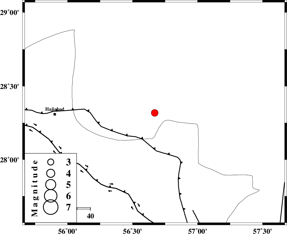
| Location | Lat:28.318 Lon: 56.67 |
| Region | Kerman Province, 75 km -East of Hajiabad |
Nearest Cities |
|
| 20 km West of Sarkhan, Kerman Province | |
| 32 km South East of Shahmaran, Kerman Province | |
| 33 km South East of Arzuieeh, Kerman Province | |
| 54 km North East of Fareqan, Hormozgan Province | |
| 60 km South West of Dolatabad, Kerman Province | |
| Depth | 12 km |
| Agency | |
Faults within 150 km: |
|
| MAIN_ZAGROS_R_F (Length: 1106 km) , Distance to epicenter: 22 km | |
| HZF2 (Length: 437 km) , Distance to epicenter: 64 km | |
| ZENDAN_MINAB_F_Z1 (Length: 183 km) , Distance to epicenter: 79 km | |
| Number of Phases | 8 |
| RMS | 0.5 |
| Number of Stations | 8 |
| Error in Latitude | >3.7 km |
| Error in Longitude | 3.7 km |
| Error in Depth | 24 km |
Download waveform in seisan format
to download seisan software Click here
to access information about IIEES stations Click here
Amplitude | ||||||||
| UID | Agency | Station | Component | Amplitude | Period | Arrival Time | Proccessing Time | Signal Clip |
| 197815 | IIEES SC | KRBR | Z | 1 | 1 | 2025-03-28 21:38:46 | 2025-04-09 08:06:00 | n |
| 197816 | IIEES SC | TABS | Z | 0.02 | 1 | 2025-03-28 21:39:38 | 2025-04-09 08:06:00 | n |
| 197817 | IIEES SC | SHRT | Z | 0.02 | 1 | 2025-03-28 21:39:49 | 2025-04-09 08:06:00 | n |
Phase | ||||||||||||
| Agency | Station | Component | Phase Type | Phase Quality | First Motion | Observed Arrival Time | Time Residual | Loc. Flag | Input Weight | Distance | Azimuth | |
| IIEES SC | KRBR | Z | EPg | E | 2025-03-28 21:38:46 | 0.1 | y | 0 | 185 | 3 | ||
| IIEES SC | GHIR | Z | EPn | E | 2025-03-28 21:39:08 | -0.1 | y | 0 | 361 | 269 | ||
| IIEES SC | UOSS | Z | EPn | E | 2025-03-28 21:39:13 | 2.7 | n | 4 | 377 | 187 | ||
| IIEES SC | ZHSF | Z | EPn | E | 2025-03-28 21:39:16 | -0.8 | y | 0 | 424 | 70 | ||
| IIEES SC | IRSR | Z | EPn | E | 2025-03-28 21:39:18 | 0.2 | y | 0 | 440 | 110 | ||
| IIEES SC | YZKH | Z | EPn | E | 2025-03-28 21:39:24 | -0.8 | y | 0 | 494 | 336 | ||
| IIEES SC | TABS | Z | EPn | E | 2025-03-28 21:39:38 | 0.7 | y | 0 | 593 | 4 | ||
| IIEES SC | SHRT | Z | EPn | E | 2025-03-28 21:39:49 | 0.6 | y | 0 | 684 | 30 | ||