Magnitude |
:3.1 |
| Date & Time (UTC) | 2025-08-22 20:47:34.2 |
| Date & Time (Local) | 1404/6/1 00:17:34.2 |
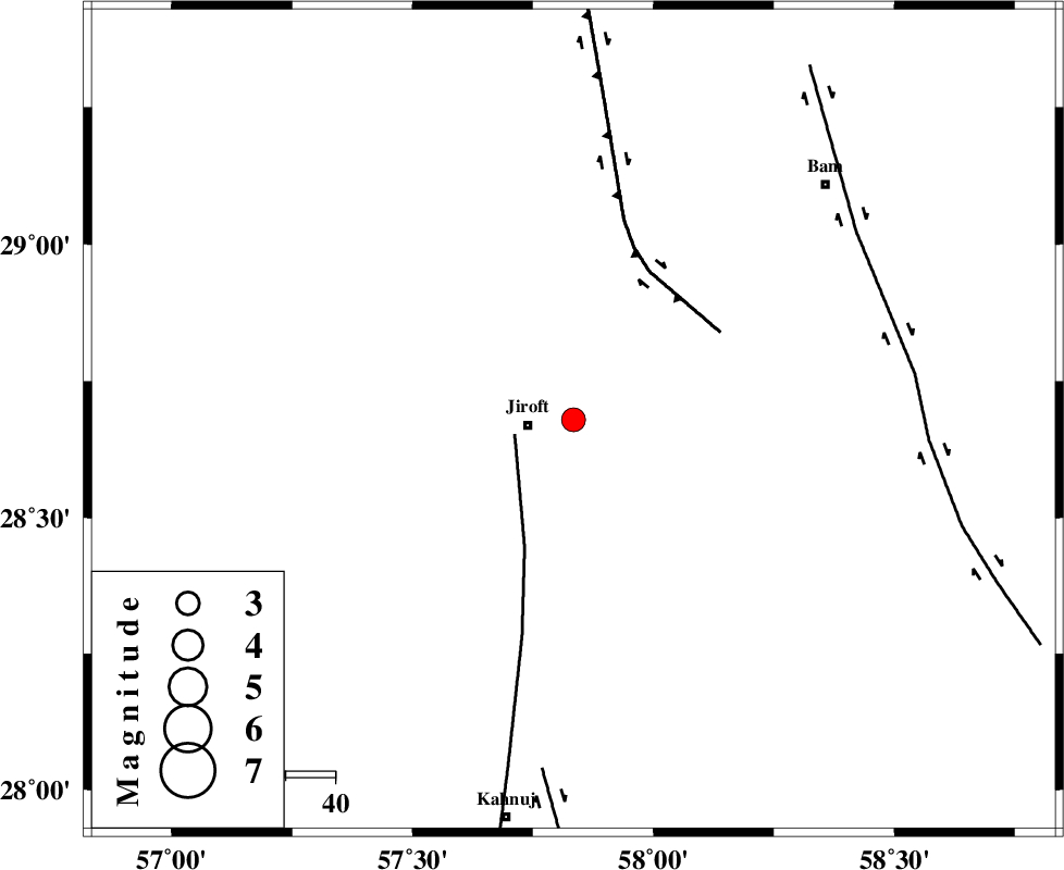
| Location | Lat:28.679 Lon: 57.834 |
| Region | Kerman Province, 9 km of Jiroft |
Nearest Cities |
|
| 8 km North of Dolatabad, Kerman Province | |
| 9 km North of Jiroft, Kerman Province | |
| 12 km West of Mijan-e sofla, Kerman Province | |
| 17 km North East of Khatunabad-e zangian, Kerman Province | |
| 19 km South of Saghdar, Kerman Province | |
| Depth | 12 km |
| Agency | |
Faults within 150 km: |
|
| SABZEVARAN_F (Length: 190 km) , Distance to epicenter: 12 km | |
| GOWK_F (Length: 152 km) , Distance to epicenter: 34 km | |
| BAM_F (Length: 118 km) , Distance to epicenter: 69 km | |
| Number of Phases | 10 |
| RMS | 1 |
| Number of Stations | 10 |
| Error in Latitude | >8.2 km |
| Error in Longitude | 8.2 km |
| Error in Depth | 999 km |
Download waveform in seisan format
to download seisan software Click here
to access information about IIEES stations Click here
Amplitude | ||||||||
| UID | Agency | Station | Component | Amplitude | Period | Arrival Time | Proccessing Time | Signal Clip |
| 198911 | IIEES SC | UOSS | Z | 0.02 | 1 | 2025-08-22 20:48:38 | 2025-08-26 05:30:00 | n |
| 198912 | IIEES SC | SHRT | Z | 0.02 | 1 | 2025-08-22 20:48:57 | 2025-08-26 05:30:00 | n |
Phase | ||||||||||||
| Agency | Station | Component | Phase Type | Phase Quality | First Motion | Observed Arrival Time | Time Residual | Loc. Flag | Input Weight | Distance | Azimuth | |
| IIEES SC | KRBR | Z | EPg | E | 2025-08-22 20:47:56 | -7.2 | n | 4 | 178 | 324 | ||
| IIEES SC | ZHSF | Z | EPn | E | 2025-08-22 20:48:19 | -0.9 | y | 0 | 304 | 70 | ||
| IIEES SC | IRSR | Z | EPn | E | 2025-08-22 20:48:24 | -1.1 | y | 0 | 353 | 122 | ||
| IIEES SC | BSRN | Z | EPn | E | 2025-08-22 20:48:15 | -14.8 | n | 4 | 385 | 19 | ||
| IIEES SC | CHBR | Z | EPn | E | 2025-08-22 20:48:34 | -0.8 | y | 0 | 431 | 142 | ||
| IIEES SC | UOSS | Z | EPn | E | 2025-08-22 20:48:38 | 1 | y | 0 | 444 | 201 | ||
| IIEES SC | GHIR | Z | EPn | E | 2025-08-22 20:48:40 | -0.9 | y | 0 | 477 | 265 | ||
| IIEES SC | YZKH | Z | EPn | E | 2025-08-22 20:48:19 | -26.7 | n | 4 | 516 | 323 | ||
| IIEES SC | TABS | Z | EPn | E | 2025-08-22 20:49:07 | 16.8 | n | 4 | 555 | 353 | ||
| IIEES SC | SHRT | Z | EPn | E | 2025-08-22 20:48:57 | 1.1 | y | 0 | 598 | 23 | ||