Magnitude |
:2.7 |
| Date & Time (UTC) | 2017-07-13 17:26:21.1 |
| Date & Time (Local) | 1396/4/22 21:56:21.1 |
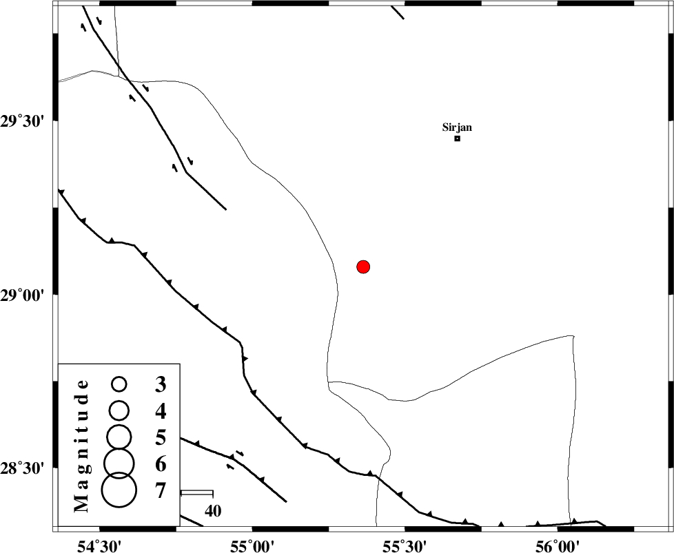
| Location | Lat:29.079 Lon: 55.363 |
| Region | Kerman Province, 51 km South-West of Sirjan |
Nearest Cities |
|
| 48 km South West of Sharifabad, Kerman Province | |
| 48 km South West of Najafabad, Kerman Province | |
| 51 km South West of Malekabad, Kerman Province | |
| 51 km South West of Sirjan, Kerman Province | |
| 56 km South West of Mahmud Abad, Kerman Province | |
| Depth | 18 km |
| Agency | |
Faults within 150 km: |
|
| MAIN_ZAGROS_R_F (Length: 1106 km) , Distance to epicenter: 46 km | |
| SHAHR_E_BABAK_F1 (Length: 392 km) , Distance to epicenter: 47 km | |
| HZF1 (Length: 102 km) , Distance to epicenter: 74 km | |
| Number of Phases | 5 |
| RMS | 0.2 |
| Number of Stations | 3 |
| Error in Latitude | >1.7 km |
| Error in Longitude | 4.3 km |
| Error in Depth | 7.9 km |
Download waveform in seisan format
to download seisan software Click here
to access information about IIEES stations Click here
Amplitude | ||||||||
| UID | Agency | Station | Component | Amplitude | Period | Arrival Time | Proccessing Time | Signal Clip |
| 117651 | IIEES | KRBR | E | 163 | 0.56 | 2017-07-13 17:27:13 | 2017-07-15 10:53:00 | n |
| 117652 | IIEES | KRBR | N | 121.9 | 0.43 | 2017-07-13 17:27:15 | 2017-07-15 10:53:00 | n |
| 117653 | IIEES | BNDS | E | 42.4 | 0.43 | 2017-07-13 17:27:34 | 2017-07-15 10:53:00 | n |
| 117654 | IIEES | GHIR | E | 25.2 | 0.53 | 2017-07-13 17:27:36 | 2017-07-15 10:53:00 | n |
| 117655 | IIEES | GHIR | N | 25.5 | 0.35 | 2017-07-13 17:27:42 | 2017-07-15 10:53:00 | n |
Phase | ||||||||||||
| Agency | Station | Component | Phase Type | Phase Quality | First Motion | Observed Arrival Time | Time Residual | Loc. Flag | Input Weight | Distance | Azimuth | |
| IIEES | KRBR | Z | Pg | E | 2017-07-13 17:26:48 | -0.27 | y | 168 | 53 | |||
| IIEES | KRBR | N | Sg | E | 2017-07-13 17:27:09 | 0.21 | y | 168 | 53 | |||
| IIEES | BNDS | Z | Pn | E | 2017-07-13 17:26:53 | -0.1 | y | 202 | 157 | |||
| IIEES | BNDS | N | Sg | E | 2017-07-13 17:27:18 | 0.06 | y | 202 | 157 | |||
| IIEES | GHIR | Z | Pn | E | 2017-07-13 17:26:59 | 0.11 | y | 248 | 250 | |||