Magnitude |
:3.1 |
| Date & Time (UTC) | 2021-07-31 14:25:23.4 |
| Date & Time (Local) | 1400/5/9 18:55:23.4 |
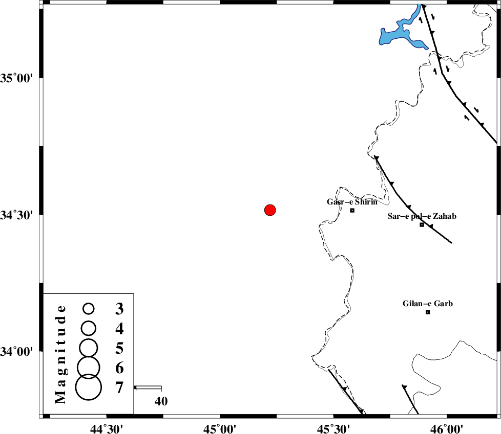
| Location | Lat:34.517 Lon: 45.22 |
| Region | Iraq, 33 km -West of Qasr-E-Shirin |
Nearest Cities |
|
| 27 km North West of Khosravi, Kermanshah Province | |
| 33 km North West of Qasr-E-Shirin, Kermanshah Province | |
| 35 km North West of Seyyed sohrab, Kermanshah Province | |
| 41 km West of Aqabarar, Kermanshah Province | |
| 50 km West of Mirmiru, Kermanshah Province | |
| Depth | 12 km |
| Agency | |
Faults within 150 km: |
|
| MFF8 (Length: 48 km) , Distance to epicenter: 47 km | |
| ZFF4 (Length: 128 km) , Distance to epicenter: 69 km | |
| HZF4 (Length: 492 km) , Distance to epicenter: 88 km | |
| Number of Phases | 7 |
| RMS | 0.5 |
| Number of Stations | 7 |
| Error in Latitude | >6.4 km |
| Error in Longitude | 6.4 km |
| Error in Depth | 15.6 km |
Download waveform in seisan format
to download seisan software Click here
to access information about IIEES stations Click here
Amplitude | ||||||||
| UID | Agency | Station | Component | Amplitude | Period | Arrival Time | Proccessing Time | Signal Clip |
| 164572 | IIEES SC | ILBA | Z | 0.3 | 1 | 2021-07-31 14:25:46 | 2021-08-03 08:28:00 | n |
| 164573 | IIEES SC | MAHB | Z | 0.5 | 1 | 2021-07-31 14:26:02 | 2021-08-03 08:28:00 | n |
| 164574 | IIEES SC | GTMR | Z | 0.05 | 1 | 2021-07-31 14:26:23 | 2021-08-03 08:28:00 | n |
| 164575 | IIEES SC | KHMZ | Z | 0.03 | 1 | 2021-07-31 14:26:27 | 2021-08-03 08:28:00 | n |
Phase | ||||||||||||
| Agency | Station | Component | Phase Type | Phase Quality | First Motion | Observed Arrival Time | Time Residual | Loc. Flag | Input Weight | Distance | Azimuth | |
| IIEES SC | ILBA | Z | EPg | E | 2021-07-31 14:25:46 | 0.3 | y | 0 | 135 | 137 | ||
| IIEES SC | SNGE | Z | EPn | E | 2021-07-31 14:25:56 | -0.2 | y | 0 | 205 | 72 | ||
| IIEES SC | MAHB | Z | EPn | E | 2021-07-31 14:26:02 | -0.2 | y | 0 | 253 | 10 | ||
| IIEES SC | AZR | Z | EPn | E | 2021-07-31 14:26:16 | 0.1 | y | 0 | 357 | 11 | ||
| IIEES SC | QABG | Z | EPn | E | 2021-07-31 14:26:24 | 0.8 | y | 0 | 419 | 72 | ||
| IIEES SC | GTMR | Z | EPn | E | 2021-07-31 14:26:23 | -1 | y | 0 | 427 | 122 | ||
| IIEES SC | KHMZ | Z | EPn | E | 2021-07-31 14:26:27 | 0.2 | y | 0 | 446 | 101 | ||