Magnitude |
:3.1 |
| Date & Time (UTC) | 2021-07-31 14:22:49.0 |
| Date & Time (Local) | 1400/5/9 18:52:49.0 |
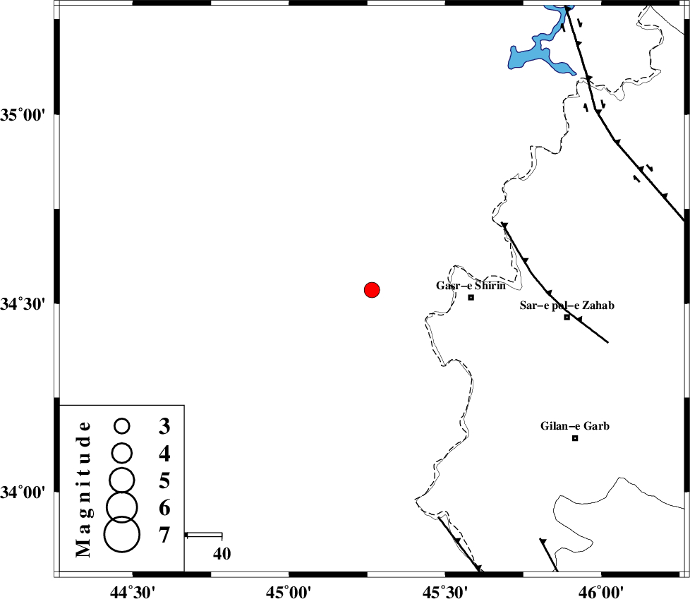
| Location | Lat:34.536 Lon: 45.265 |
| Region | Iraq, 29 km -West of Qasr-E-Shirin |
Nearest Cities |
|
| 24 km North West of Khosravi, Kermanshah Province | |
| 29 km North West of Qasr-E-Shirin, Kermanshah Province | |
| 32 km North West of Seyyed sohrab, Kermanshah Province | |
| 37 km West of Aqabarar, Kermanshah Province | |
| 46 km West of Mirmiru, Kermanshah Province | |
| Depth | 12 km |
| Agency | |
Faults within 150 km: |
|
| MFF8 (Length: 48 km) , Distance to epicenter: 43 km | |
| ZFF4 (Length: 128 km) , Distance to epicenter: 70 km | |
| HZF4 (Length: 492 km) , Distance to epicenter: 83 km | |
| Number of Phases | 8 |
| RMS | 0.4 |
| Number of Stations | 8 |
| Error in Latitude | >5.9 km |
| Error in Longitude | 5.9 km |
| Error in Depth | 12.3 km |
Download waveform in seisan format
to download seisan software Click here
to access information about IIEES stations Click here
Amplitude | ||||||||
| UID | Agency | Station | Component | Amplitude | Period | Arrival Time | Proccessing Time | Signal Clip |
| 164576 | IIEES SC | ILBA | Z | 0.6 | 1 | 2021-07-31 14:23:11 | 2021-08-03 08:39:00 | n |
| 164577 | IIEES SC | ILBA | Z | 0.6 | 1 | 2021-07-31 14:23:27 | 2021-08-03 08:39:00 | n |
| 164578 | IIEES SC | GTMR | Z | 0.08 | 1 | 2021-07-31 14:23:48 | 2021-08-03 08:39:00 | n |
| 164579 | IIEES SC | KHMZ | Z | 0.04 | 1 | 2021-07-31 14:23:52 | 2021-08-03 08:39:00 | n |
| 164580 | IIEES SC | GRMI | Z | 0.01 | 1 | 2021-07-31 14:24:02 | 2021-08-03 08:39:00 | n |
Phase | ||||||||||||
| Agency | Station | Component | Phase Type | Phase Quality | First Motion | Observed Arrival Time | Time Residual | Loc. Flag | Input Weight | Distance | Azimuth | |
| IIEES SC | ILBA | Z | EPg | E | 2021-07-31 14:23:11 | 0 | y | 0 | 133 | 139 | ||
| IIEES SC | ILBA | Z | ESg | E | 2021-07-31 14:23:27 | 0.1 | y | 0 | 133 | 139 | ||
| IIEES SC | SNGE | Z | EPn | E | 2021-07-31 14:23:21 | 0.1 | y | 0 | 200 | 72 | ||
| IIEES SC | AZR | Z | EPn | E | 2021-07-31 14:23:41 | 0.3 | y | 0 | 354 | 11 | ||
| IIEES SC | GTMR | Z | EPn | E | 2021-07-31 14:23:48 | -0.9 | y | 0 | 425 | 123 | ||
| IIEES SC | KHMZ | Z | EPn | E | 2021-07-31 14:23:52 | 0.8 | y | 0 | 442 | 102 | ||
| IIEES SC | GZV | Z | EPn | E | 2021-07-31 14:24:09 | 11.1 | n | 4 | 494 | 65 | ||
| IIEES SC | GRMI | Z | EPn | E | 2021-07-31 14:24:02 | -0.5 | y | 0 | 529 | 26 | ||