Magnitude |
:3.3 |
| Date & Time (UTC) | 2021-08-28 21:55:58.1 |
| Date & Time (Local) | 1400/6/7 02:25:58.1 |
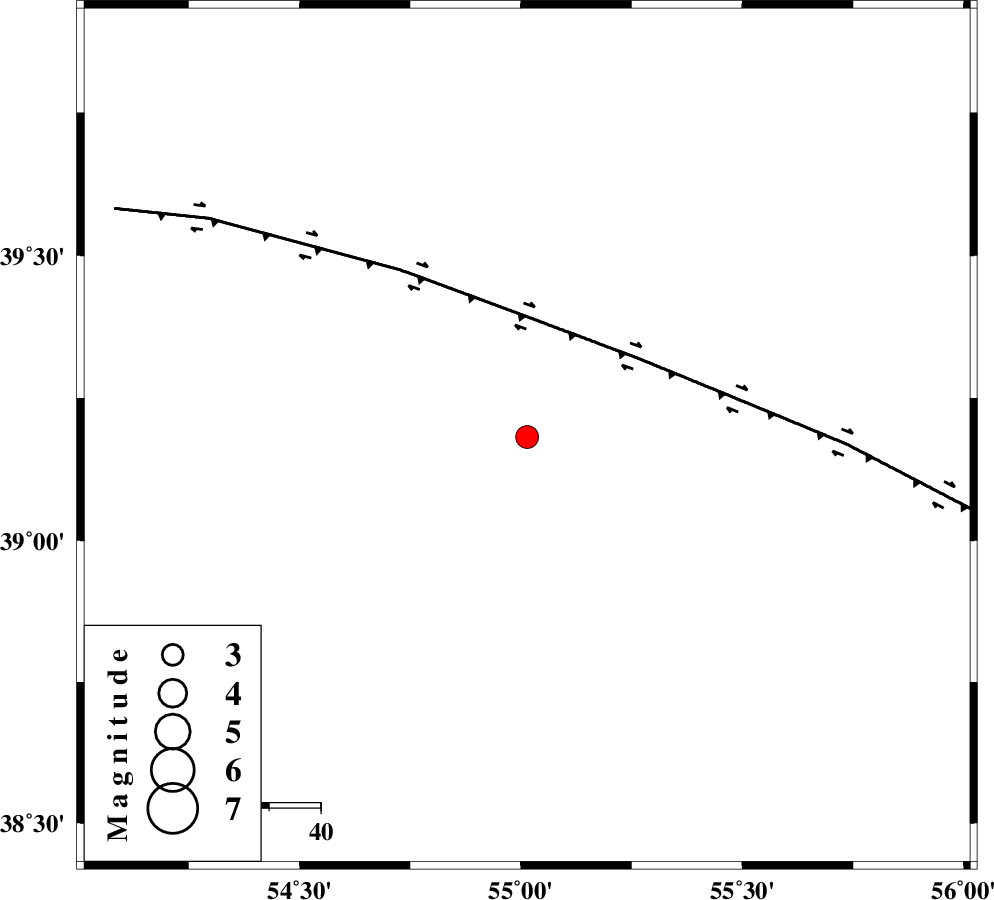
| Location | Lat:39.182 Lon: 55.014 |
| Region | Turkmenistan |
Nearest Cities |
|
| 143 km North West of Karand, Golestan Province | |
| 162 km North West of Qareh aghaj, Golestan Province | |
| 164 km North West of Moravehtappeh, Golestan Province | |
| 174 km North East of Dashliborun, Golestan Province | |
| 178 km North West of Qazanqayeh, Golestan Province | |
| Depth | 10 km |
| Agency | |
Faults within 150 km: |
|
| MAIN_KOPEHDAGH_F1 (Length: 318 km) , Distance to epicenter: 27 km | |
| MAIN_KOPEHDAGH_F2 (Length: 131 km) , Distance to epicenter: 123 km | |
| Number of Phases | 8 |
| RMS | 0.5 |
| Number of Stations | 8 |
| Error in Latitude | >5.5 km |
| Error in Longitude | 5.5 km |
| Error in Depth | 12.8 km |
Download waveform in seisan format
to download seisan software Click here
to access information about IIEES stations Click here
Amplitude | ||||||||
| UID | Agency | Station | Component | Amplitude | Period | Arrival Time | Proccessing Time | Signal Clip |
| 165002 | IIEES SC | MRVT | Z | 0.7 | 1 | 2021-08-28 21:56:30 | 2021-08-29 05:36:00 | n |
| 165003 | IIEES SC | KAGH | Z | 0.03 | 1 | 2021-08-28 21:57:08 | 2021-08-29 05:36:00 | n |
| 165004 | IIEES SC | GZV | Z | 0.05 | 1 | 2021-08-28 21:57:11 | 2021-08-29 05:36:00 | n |
| 165005 | IIEES SC | TABS | Z | 0.02 | 1 | 2021-08-28 21:57:26 | 2021-08-29 05:36:00 | n |
Phase | ||||||||||||
| Agency | Station | Component | Phase Type | Phase Quality | First Motion | Observed Arrival Time | Time Residual | Loc. Flag | Input Weight | Distance | Azimuth | |
| IIEES SC | MRVT | Z | EPg | E | 2021-08-28 21:56:30 | 0.7 | y | 0 | 193 | 151 | ||
| IIEES SC | ABGH | Z | EPn | E | 2021-08-28 21:56:39 | -0.7 | y | 0 | 272 | 184 | ||
| IIEES SC | GLO | Z | EPn | E | 2021-08-28 21:56:45 | 0.4 | y | 0 | 315 | 199 | ||
| IIEES SC | SHRO | Z | EPn | E | 2021-08-28 21:56:51 | -0.1 | y | 0 | 363 | 166 | ||
| IIEES SC | KAGH | Z | EPn | E | 2021-08-28 21:57:08 | -0.3 | y | 0 | 500 | 120 | ||
| IIEES SC | GZV | Z | EPn | E | 2021-08-28 21:57:11 | 0.2 | y | 0 | 524 | 234 | ||
| IIEES SC | TABS | Z | EPn | E | 2021-08-28 21:57:26 | 0.2 | y | 0 | 642 | 163 | ||
| IIEES SC | YZKH | Z | EPn | E | 2021-08-28 21:57:39 | -0.5 | y | 0 | 754 | 183 | ||