Magnitude |
:3.6 |
| Date & Time (UTC) | 2025-05-06 02:22:41.0 |
| Date & Time (Local) | 1404/2/16 05:52:41.0 |
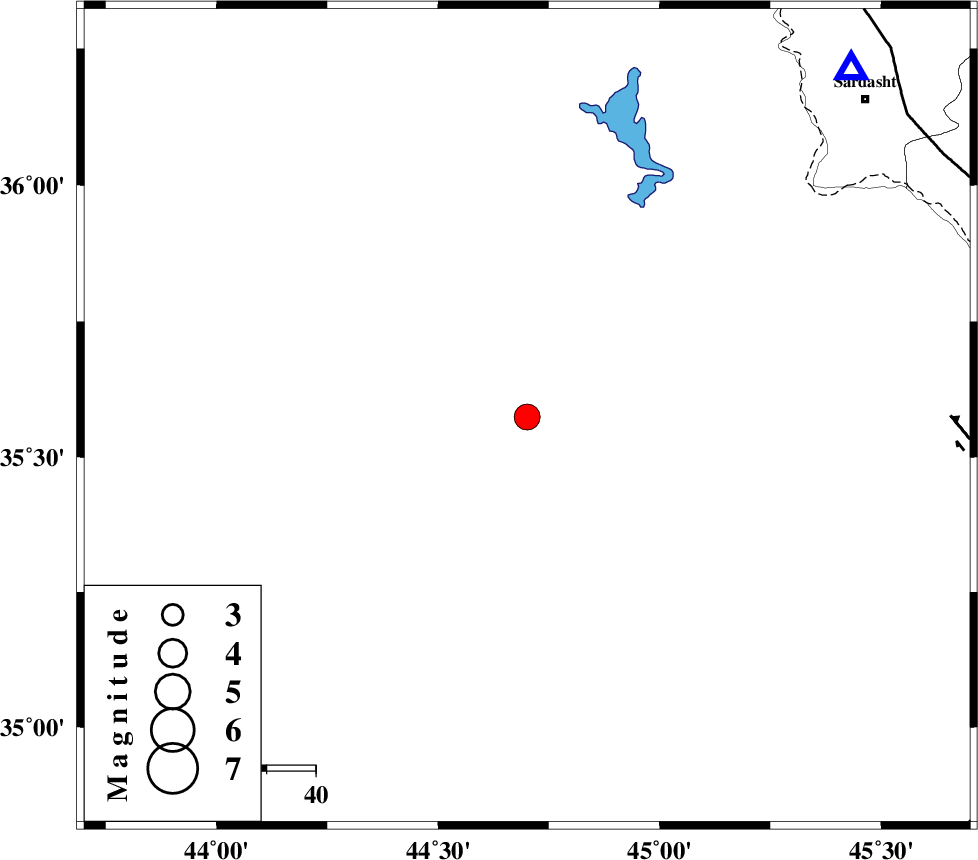
| Location | Lat:35.574 Lon: 44.701 |
| Region | Iraq, 67 km -West of Sulaymaniyah |
Nearest Cities |
|
| 67 km North West of Sulaymaniyah, Iraq Province | |
| 91 km South West of Bivaran-e sofla, Azarbaijan Gharbi Province | |
| 95 km South West of Sardasht, Azarbaijan Gharbi Province | |
| 99 km South West of Bersiv, Azarbaijan Gharbi Province | |
| 100 km South West of Bolhasan, Kurdistan Province | |
| Depth | 12 km |
| Agency | |
Faults within 150 km: |
|
| HZF4 (Length: 492 km) , Distance to epicenter: 86 km | |
| PIRANSHAHR_F (Length: 253 km) , Distance to epicenter: 99 km | |
| MFF8 (Length: 48 km) , Distance to epicenter: 130 km | |
| Number of Phases | 6 |
| RMS | 0.8 |
| Number of Stations | 6 |
| Error in Latitude | >19.4 km |
| Error in Longitude | 19.4 km |
| Error in Depth | 999 km |
Download waveform in seisan format
to download seisan software Click here
to access information about IIEES stations Click here
Amplitude | ||||||||
| UID | Agency | Station | Component | Amplitude | Period | Arrival Time | Proccessing Time | Signal Clip |
| 198098 | IIEES SC | GURO | Z | 0.2 | 1 | 2025-05-06 02:23:40 | 2025-05-06 12:25:00 | n |
| 198099 | IIEES SC | ASAO | Z | 0.08 | 1 | 2025-05-06 02:23:50 | 2025-05-06 12:25:00 | n |
| 198100 | IIEES SC | GNI | Z | 0.1 | 1 | 2025-05-06 02:23:51 | 2025-05-06 12:25:00 | n |
Phase | ||||||||||||
| Agency | Station | Component | Phase Type | Phase Quality | First Motion | Observed Arrival Time | Time Residual | Loc. Flag | Input Weight | Distance | Azimuth | |
| IIEES SC | SRSL | Z | EPg | E | 2025-05-06 02:22:54 | -3 | n | 4 | 97 | 43 | ||
| IIEES SC | GURO | Z | EPn | E | 2025-05-06 02:23:40 | 0.6 | y | 0 | 407 | 324 | ||
| IIEES SC | GIDE | Z | EPn | E | 2025-05-06 02:23:50 | 1.1 | y | 0 | 484 | 72 | ||
| IIEES SC | ASAO | Z | EPn | E | 2025-05-06 02:23:50 | -0.8 | y | 0 | 499 | 103 | ||
| IIEES SC | GNI | Z | EPn | E | 2025-05-06 02:23:51 | -0.8 | y | 0 | 508 | 0 | ||
| IIEES SC | GHVR | Z | EPn | E | 2025-05-06 02:24:04 | -0.1 | y | 0 | 610 | 101 | ||