Magnitude |
:3 |
| Date & Time (UTC) | 2025-01-22 21:17:31.1 |
| Date & Time (Local) | 1403/11/4 00:47:31.1 |
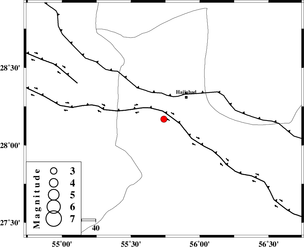
| Location | Lat:28.168 Lon: 55.739 |
| Region | Hormozgan Province, 22 km South-West of Hajiabad |
Nearest Cities |
|
| 22 km South West of Hajiabad, Hormozgan Province | |
| 46 km North East of Darz, Fars Province | |
| 51 km North West of Fareqan, Hormozgan Province | |
| 54 km East of Fadami, Fars Province | |
| 55 km South East of Doborji, Fars Province | |
| Depth | 12 km |
| Agency | |
Faults within 150 km: |
|
| HZF2 (Length: 437 km) , Distance to epicenter: 5 km | |
| MAIN_ZAGROS_R_F (Length: 1106 km) , Distance to epicenter: 17 km | |
| HZF1 (Length: 102 km) , Distance to epicenter: 67 km | |
| Number of Phases | 7 |
| RMS | 0.6 |
| Number of Stations | 7 |
| Error in Latitude | >4.7 km |
| Error in Longitude | 4.7 km |
| Error in Depth | 980.4 km |
Download waveform in seisan format
to download seisan software Click here
to access information about IIEES stations Click here
Amplitude | ||||||||
| UID | Agency | Station | Component | Amplitude | Period | Arrival Time | Proccessing Time | Signal Clip |
| 198282 | IIEES SC | UOSS | Z | 0.05 | 1 | 2025-01-22 21:18:23 | 2025-05-21 12:28:00 | n |
| 198283 | IIEES SC | BSRN | Z | 0.02 | 1 | 2025-01-22 21:18:44 | 2025-05-21 12:28:00 | n |
| 198284 | IIEES SC | NASN | Z | 0.01 | 1 | 2025-01-22 21:18:51 | 2025-05-21 12:28:00 | n |
Phase | ||||||||||||
| Agency | Station | Component | Phase Type | Phase Quality | First Motion | Observed Arrival Time | Time Residual | Loc. Flag | Input Weight | Distance | Azimuth | |
| IIEES SC | KRBR | Z | EPn | E | 2025-01-22 21:18:12 | 5.1 | n | 4 | 224 | 26 | ||
| IIEES SC | GHIR | Z | EPn | E | 2025-01-22 21:18:13 | 0.3 | y | 0 | 270 | 273 | ||
| IIEES SC | UOSS | Z | EPn | E | 2025-01-22 21:18:23 | -0.5 | y | 0 | 360 | 173 | ||
| IIEES SC | YZKH | Z | EPn | E | 2025-01-22 21:18:39 | 0.2 | y | 0 | 481 | 347 | ||
| IIEES SC | IRSR | Z | EPn | E | 2025-01-22 21:18:44 | 0.7 | y | 0 | 523 | 105 | ||
| IIEES SC | BSRN | Z | EPn | E | 2025-01-22 21:18:44 | -0.8 | y | 0 | 533 | 38 | ||
| IIEES SC | NASN | Z | EPn | E | 2025-01-22 21:18:51 | -1 | y | 0 | 586 | 331 | ||