Magnitude |
:2.9 |
| Date & Time (UTC) | 2025-08-21 19:55:06.3 |
| Date & Time (Local) | 1404/5/30 23:25:06.3 |
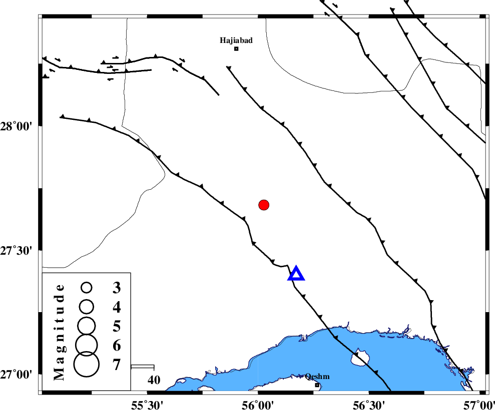
| Location | Lat:27.682 Lon: 56.026 |
| Region | Hormozgan Province, 71 km South-East of Hajiabad |
Nearest Cities |
|
| 13 km North East of Fin, Hormozgan Province | |
| 42 km South West of Fareqan, Hormozgan Province | |
| 61 km North West of Bandar-e abbas, Hormozgan Province | |
| 63 km South East of Darz, Fars Province | |
| 71 km South East of Hajiabad, Hormozgan Province | |
| Depth | 12 km |
| Agency | |
Faults within 150 km: |
|
| HZF2 (Length: 437 km) , Distance to epicenter: 27 km | |
| MAIN_ZAGROS_R_F (Length: 1106 km) , Distance to epicenter: 65 km | |
| MFF1 (Length: 180 km) , Distance to epicenter: 76 km | |
| Number of Phases | 6 |
| RMS | 0.6 |
| Number of Stations | 6 |
| Error in Latitude | >7.3 km |
| Error in Longitude | 7.3 km |
| Error in Depth | 999 km |
Download waveform in seisan format
to download seisan software Click here
to access information about IIEES stations Click here
Amplitude | ||||||||
| UID | Agency | Station | Component | Amplitude | Period | Arrival Time | Proccessing Time | Signal Clip |
| 198916 | IIEES SC | KRBR | Z | 0.2 | 1 | 2025-08-21 19:55:47 | 2025-08-26 06:02:00 | n |
| 198917 | IIEES SC | UOSS | Z | 0.08 | 1 | 2025-08-21 19:55:51 | 2025-08-26 06:02:00 | n |
| 198918 | IIEES SC | IRSR | Z | 0.008 | 1 | 2025-08-21 19:56:15 | 2025-08-26 06:02:00 | n |
Phase | ||||||||||||
| Agency | Station | Component | Phase Type | Phase Quality | First Motion | Observed Arrival Time | Time Residual | Loc. Flag | Input Weight | Distance | Azimuth | |
| IIEES SC | KRBR | Z | EPn | E | 2025-08-21 19:55:47 | -0.4 | y | 0 | 265 | 16 | ||
| IIEES SC | UOSS | Z | EPn | E | 2025-08-21 19:55:51 | -0.8 | y | 0 | 304 | 177 | ||
| IIEES SC | GHIR | Z | EPn | E | 2025-08-21 19:55:52 | 0.5 | y | 0 | 306 | 283 | ||
| IIEES SC | IRSR | Z | EPn | E | 2025-08-21 19:56:15 | 0.9 | y | 0 | 485 | 99 | ||
| IIEES SC | CHBR | Z | EPn | E | 2025-08-21 19:56:17 | 0.8 | y | 0 | 500 | 118 | ||
| IIEES SC | YZKH | Z | EPn | E | 2025-08-21 19:56:15 | -6.1 | n | 4 | 540 | 345 | ||