Magnitude |
:3.5 |
| Date & Time (UTC) | 2025-08-21 13:17:57.7 |
| Date & Time (Local) | 1404/5/30 16:47:57.7 |
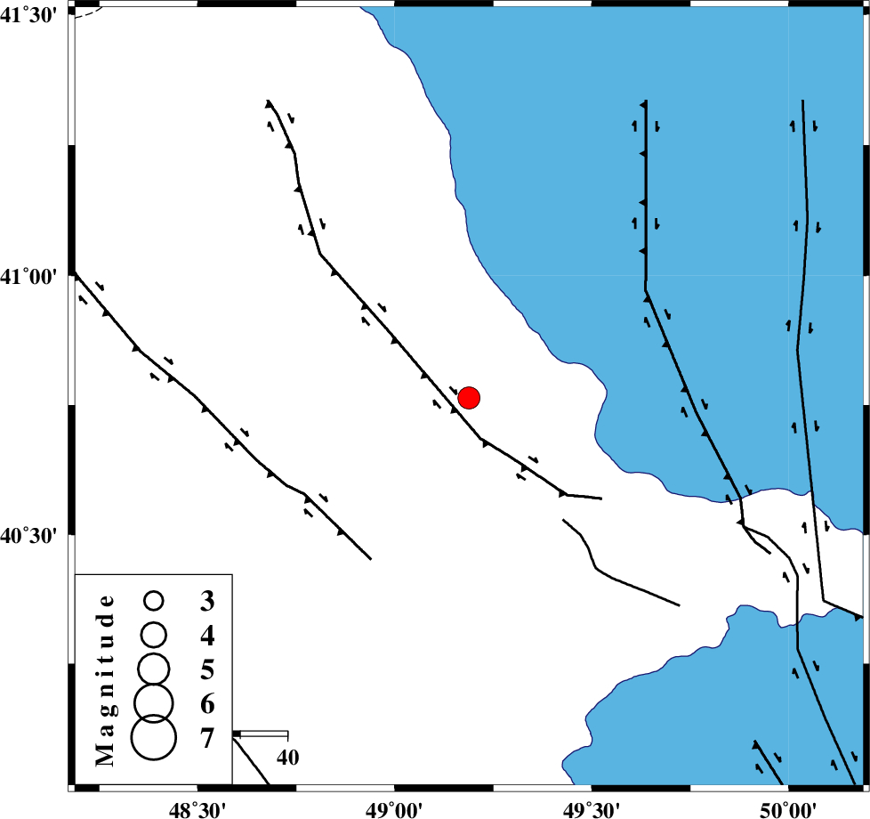
| Location | Lat:40.764 Lon: 49.188 |
| Region | Azerbaijan, 72 km North-West of Baku |
Nearest Cities |
|
| 72 km North West of Baku, Azerbaijan Province | |
| 158 km North East of Kushlu, Ardebil Province | |
| 161 km North East of Tazeh kand-e gadim, Ardebil Province | |
| 164 km North East of Pars Abad, Ardebil Province | |
| 170 km North East of Bileh Savar, Ardebil Province | |
| Depth | 12 km |
| Agency | |
Faults within 150 km: |
|
| Number of Phases | 7 |
| RMS | 0.1 |
| Number of Stations | 7 |
| Error in Latitude | >3.3 km |
| Error in Longitude | 3.3 km |
| Error in Depth | 235.6 km |
Download waveform in seisan format
to download seisan software Click here
to access information about IIEES stations Click here
Amplitude | ||||||||
| UID | Agency | Station | Component | Amplitude | Period | Arrival Time | Proccessing Time | Signal Clip |
| 198923 | IIEES SC | GNI | Z | 0.2 | 1 | 2025-08-21 13:18:53 | 2025-08-26 06:33:00 | n |
| 198924 | IIEES SC | ASAO | Z | 0.02 | 1 | 2025-08-21 13:19:31 | 2025-08-26 06:33:00 | n |
Phase | ||||||||||||
| Agency | Station | Component | Phase Type | Phase Quality | First Motion | Observed Arrival Time | Time Residual | Loc. Flag | Input Weight | Distance | Azimuth | |
| IIEES SC | GNI | Z | EPn | E | 2025-08-21 13:18:53 | 0 | y | 0 | 383 | 260 | ||
| IIEES SC | KIV | Z | EPn | E | 2025-08-21 13:19:14 | -10.8 | n | 4 | 642 | 303 | ||
| IIEES SC | ASAO | Z | EPn | E | 2025-08-21 13:19:31 | -0.3 | y | 0 | 694 | 174 | ||
| IIEES SC | NASN | Z | EPn | E | 2025-08-21 13:20:03 | 0.3 | y | 0 | 941 | 160 | ||
| IIEES SC | KAGH | Z | EPn | E | 2025-08-21 13:20:13 | 0 | y | 0 | 1027 | 114 | ||
| IIEES SC | TABS | Z | EPn | E | 2025-08-21 13:20:17 | 0.2 | y | 0 | 1058 | 138 | ||
| IIEES SC | SHRT | Z | EPn | E | 2025-08-21 13:20:42 | -0.1 | y | 0 | 1263 | 129 | ||