Magnitude |
:4 |
| Date & Time (UTC) | 2025-09-01 08:36:00.3 |
| Date & Time (Local) | 1404/6/10 12:06:00.3 |
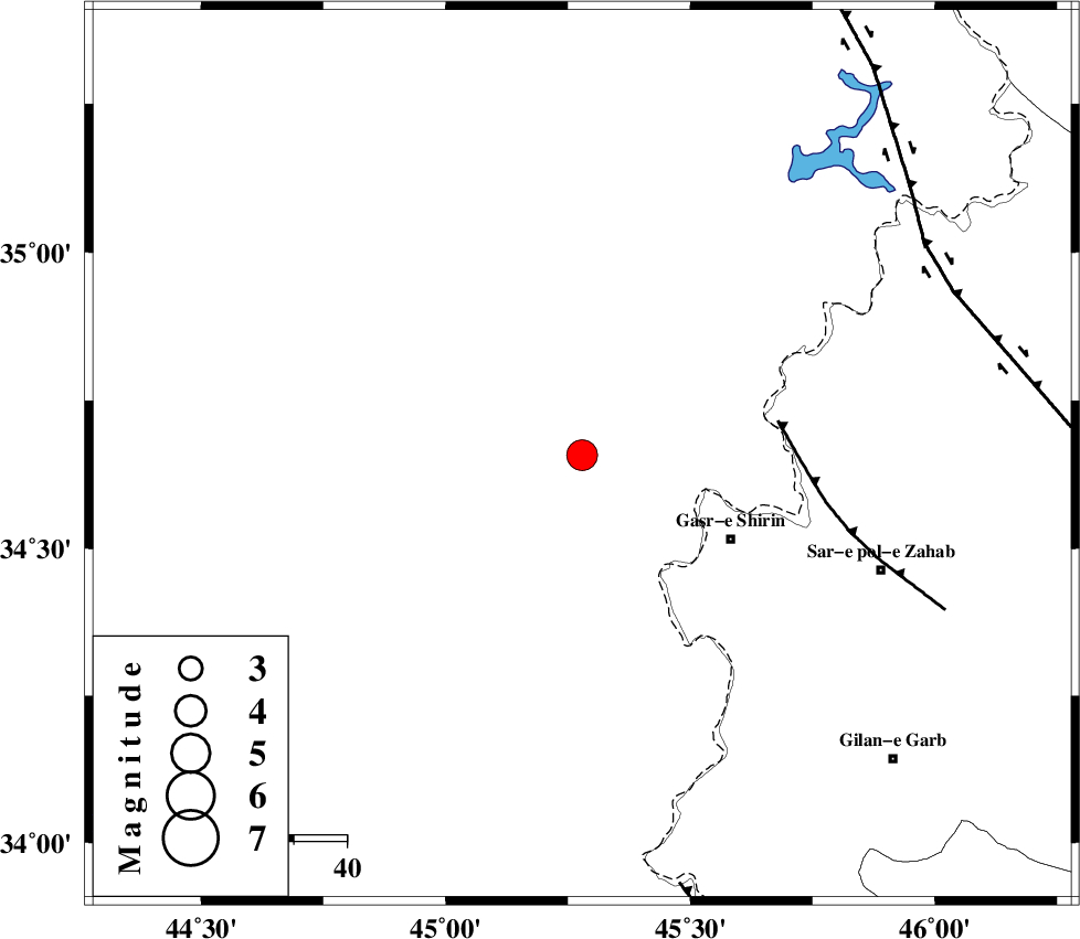
| Location | Lat:34.658 Lon: 45.279 |
| Region | Iraq, 32 km North-West of Qasr-E-Shirin |
Nearest Cities |
|
| 32 km North West of Qasr-E-Shirin, Kermanshah Province | |
| 34 km North West of Khosravi, Kermanshah Province | |
| 37 km North West of Seyyed sohrab, Kermanshah Province | |
| 38 km North West of Aqabarar, Kermanshah Province | |
| 42 km West of Tappeh rash, Kermanshah Province | |
| Depth | 16 km |
| Agency | |
Faults within 150 km: |
|
| MFF8 (Length: 48 km) , Distance to epicenter: 37 km | |
| HZF4 (Length: 492 km) , Distance to epicenter: 75 km | |
| ZFF4 (Length: 128 km) , Distance to epicenter: 83 km | |
| Number of Phases | 7 |
| RMS | 0.5 |
| Number of Stations | 7 |
| Error in Latitude | >20.3 km |
| Error in Longitude | 20.3 km |
| Error in Depth | 37.9 km |
Download waveform in seisan format
to download seisan software Click here
to access information about IIEES stations Click here
Amplitude | ||||||||
| UID | Agency | Station | Component | Amplitude | Period | Arrival Time | Proccessing Time | Signal Clip |
| 198984 | IIEES SC | SRSL | Z | 4 | 1 | 2025-09-01 08:36:29 | 2025-09-02 04:52:00 | n |
| 198985 | IIEES SC | SRSL | Z | 4 | 1 | 2025-09-01 08:36:48 | 2025-09-02 04:52:00 | n |
| 198986 | IIEES SC | GHVR | Z | 0.1 | 1 | 2025-09-01 08:37:16 | 2025-09-02 04:52:00 | n |
| 198987 | IIEES SC | NASN | Z | 0.07 | 1 | 2025-09-01 08:37:37 | 2025-09-02 04:52:00 | n |
Phase | ||||||||||||
| Agency | Station | Component | Phase Type | Phase Quality | First Motion | Observed Arrival Time | Time Residual | Loc. Flag | Input Weight | Distance | Azimuth | |
| IIEES SC | SRSL | Z | EPg | E | 2025-09-01 08:36:29 | 0.5 | y | 0 | 173 | 5 | ||
| IIEES SC | SRSL | Z | ESg | E | 2025-09-01 08:36:48 | -0.4 | y | 0 | 173 | 5 | ||
| IIEES SC | GHVR | Z | EPn | E | 2025-09-01 08:37:16 | 0.6 | y | 0 | 548 | 92 | ||
| IIEES SC | DAMV | Z | EPn | E | 2025-09-01 08:37:08 | -16.9 | n | 4 | 619 | 80 | ||
| IIEES SC | NASN | Z | EPn | E | 2025-09-01 08:37:37 | -0.8 | y | 0 | 728 | 106 | ||
| IIEES SC | YZKH | Z | EPn | E | 2025-09-01 08:37:51 | -8.8 | n | 4 | 901 | 106 | ||
| IIEES SC | GHIR | Z | EPn | E | 2025-09-01 08:38:14 | -0.3 | y | 0 | 1018 | 134 | ||