Magnitude |
:2.8 |
| Date & Time (UTC) | 2025-08-31 22:04:45.3 |
| Date & Time (Local) | 1404/6/10 01:34:45.3 |
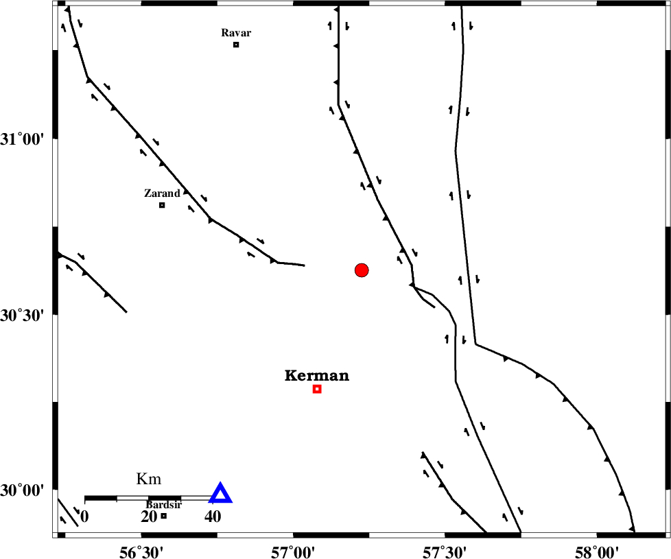
| Location | Lat:30.626 Lon: 57.225 |
| Region | Kerman Province, 40 km North-East of Kerman |
Nearest Cities |
|
| 9 km of Harjand, Kerman Province | |
| 14 km North of Dehlulu, Kerman Province | |
| 28 km South East of Hejdak, Kerman Province | |
| 28 km North East of Hutak, Kerman Province | |
| 30 km North East of Chatrud, Kerman Province | |
| Depth | 12 km |
| Agency | |
Faults within 150 km: |
|
| LAKARKUH_F (Length: 138 km) , Distance to epicenter: 16 km | |
| GOLBAF_SIRCH_F (Length: 114 km) , Distance to epicenter: 17 km | |
| KUHBANAN_F (Length: 189 km) , Distance to epicenter: 18 km | |
| Number of Phases | 7 |
| RMS | 0.7 |
| Number of Stations | 7 |
| Error in Latitude | >30.6 km |
| Error in Longitude | 57.2 km |
| Error in Depth | 12 km |
Download waveform in seisan format
to download seisan software Click here
to access information about IIEES stations Click here
Amplitude | ||||||||
| UID | Agency | Station | Component | Amplitude | Period | Arrival Time | Proccessing Time | Signal Clip |
| 198988 | IIEES SC | TABS | Z | 0.04 | 1 | 2025-08-31 22:05:35 | 2025-09-02 04:58:00 | n |
| 198989 | IIEES SC | SHRT | Z | 0.01 | 1 | 2025-08-31 22:05:47 | 2025-09-02 04:58:00 | n |
| 198990 | IIEES SC | NASN | Z | 0.01 | 1 | 2025-08-31 22:05:53 | 2025-09-02 04:58:00 | n |
Phase | ||||||||||||
| Agency | Station | Component | Phase Type | Phase Quality | First Motion | Observed Arrival Time | Time Residual | Loc. Flag | Input Weight | Distance | Azimuth | |
| IIEES SC | KRBR | Z | EPg | E | 2025-08-31 22:05:00 | 0.1 | y | 0 | 84 | 212 | ||
| IIEES SC | BSRN | Z | EPn | E | 2025-08-31 22:05:08 | -13.6 | n | 4 | 234 | 51 | ||
| IIEES SC | YZKH | Z | EPn | E | 2025-08-31 22:05:08 | -24.6 | n | 4 | 318 | 308 | ||
| IIEES SC | TABS | Z | EPn | E | 2025-08-31 22:05:35 | 1 | y | 0 | 335 | 358 | ||
| IIEES SC | SHRT | Z | EPn | E | 2025-08-31 22:05:47 | -1 | y | 0 | 442 | 41 | ||
| IIEES SC | NASN | Z | EPn | E | 2025-08-31 22:05:53 | -0.2 | y | 0 | 483 | 300 | ||
| IIEES SC | SHRO | Z | EPn | E | 2025-08-31 22:06:22 | 13.2 | n | 4 | 608 | 349 | ||