Magnitude |
:3.3 |
| Date & Time (UTC) | 2025-08-29 21:12:54.3 |
| Date & Time (Local) | 1404/6/8 00:42:54.3 |
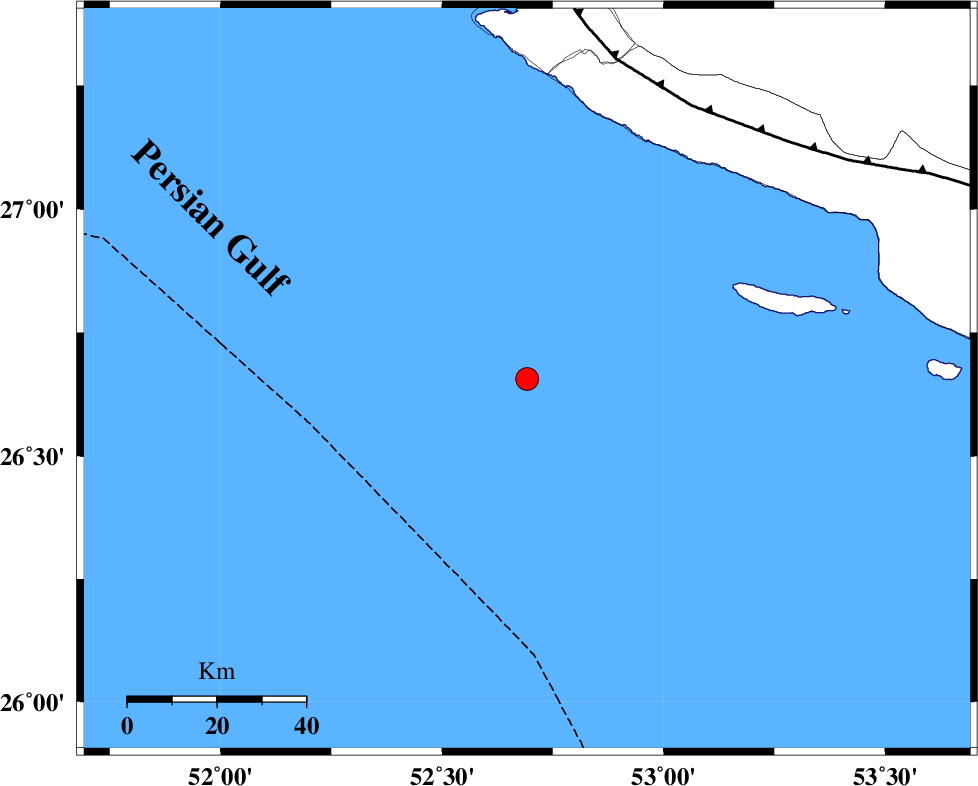
| Location | Lat:26.656 Lon: 52.692 |
| Region | Persian Gulf |
Nearest Cities |
|
| 79 km South of Chah-e mobarak, Bushehr Province | |
| 89 km South West of Lamerd, Fars Province | |
| 91 km South of Bandar-e asaluyeh, Bushehr Province | |
| 92 km South West of Khoozi, Fars Province | |
| 101 km South West of Mehr, Fars Province | |
| Depth | 12 km |
| Agency | |
Faults within 150 km: |
|
| MFF3 (Length: 292 km) , Distance to epicenter: 72 km | |
| ZFF1 (Length: 165 km) , Distance to epicenter: 105 km | |
| MFF1 (Length: 180 km) , Distance to epicenter: 142 km | |
| Number of Phases | 6 |
| RMS | 0.1 |
| Number of Stations | 6 |
| Error in Latitude | >1.6 km |
| Error in Longitude | 1.6 km |
| Error in Depth | 9 km |
Download waveform in seisan format
to download seisan software Click here
to access information about IIEES stations Click here
Amplitude | ||||||||
| UID | Agency | Station | Component | Amplitude | Period | Arrival Time | Proccessing Time | Signal Clip |
| 199004 | IIEES SC | KRBR | Z | 0.04 | 1 | 2025-08-29 21:14:10 | 2025-09-02 08:19:00 | n |
| 199005 | IIEES SC | NASN | Z | 0.01 | 1 | 2025-08-29 21:14:26 | 2025-09-02 08:19:00 | n |
| 199006 | IIEES SC | RAYN | Z | 0.01 | 1 | 2025-08-29 21:14:42 | 2025-09-02 08:19:00 | n |
Phase | ||||||||||||
| Agency | Station | Component | Phase Type | Phase Quality | First Motion | Observed Arrival Time | Time Residual | Loc. Flag | Input Weight | Distance | Azimuth | |
| IIEES SC | GHIR | Z | EPg | E | 2025-08-29 21:13:24 | 0.1 | y | 0 | 183 | 9 | ||
| IIEES SC | UOSS | Z | EPn | E | 2025-08-29 21:13:51 | -0.1 | y | 0 | 400 | 118 | ||
| IIEES SC | KRBR | Z | EPn | E | 2025-08-29 21:14:10 | 0.3 | y | 0 | 543 | 47 | ||
| IIEES SC | YZKH | Z | EPn | E | 2025-08-29 21:14:03 | -20.8 | n | 4 | 662 | 16 | ||
| IIEES SC | NASN | Z | EPn | E | 2025-08-29 21:14:26 | -0.2 | y | 0 | 681 | 1 | ||
| IIEES SC | RAYN | Z | EPn | E | 2025-08-29 21:14:42 | 0.1 | y | 0 | 804 | 244 | ||