Magnitude |
:3 |
| Date & Time (UTC) | 2014-08-19 01:22:17.3 |
| Date & Time (Local) | 1393/5/28 05:52:17.3 |
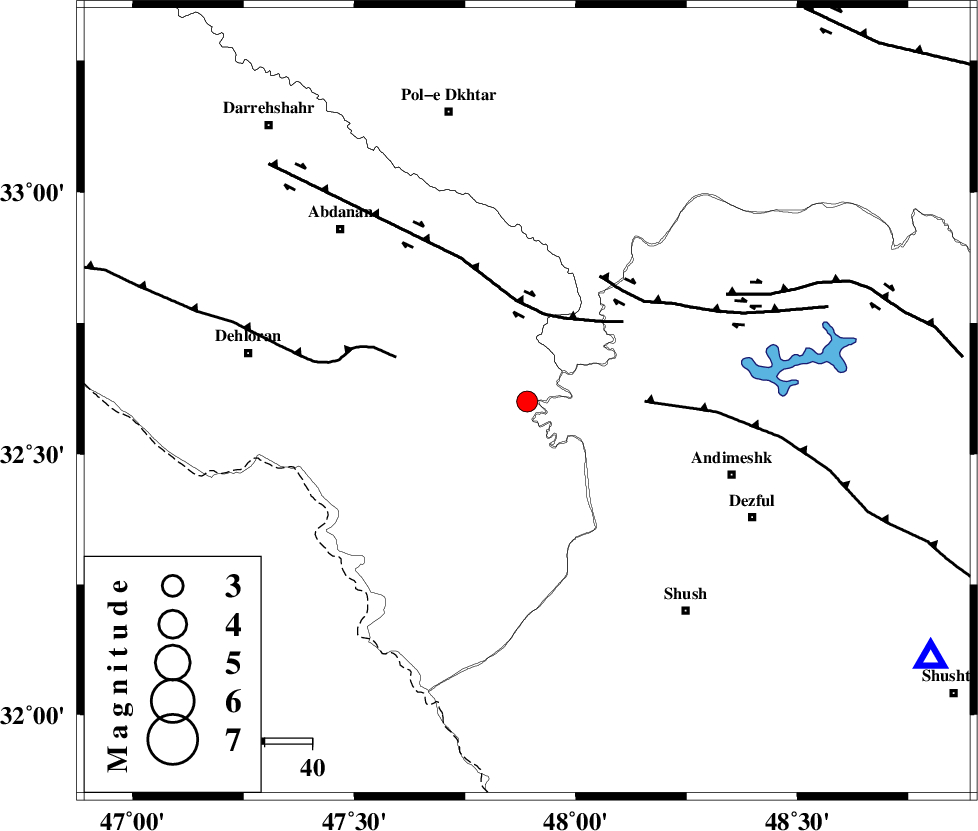
| Location | Lat:32.6 Lon: 47.89 |
| Region | Ilam Province, 46 km North-West of Andimeshk |
Nearest Cities |
|
| 35 km West of Hoseinieh, Khoozestan Province | |
| 37 km South West of Bidruyeh, Khoozestan Province | |
| 45 km South East of Sarabbagh, Ilam Province | |
| 45 km South West of Sorkhakan, Khoozestan Province | |
| 46 km North West of Andimeshk, Khoozestan Province | |
| Depth | 39 km |
| Agency | |
Faults within 150 km: |
|
| BALARUD_F_Z1 (Length: 87 km) , Distance to epicenter: 19 km | |
| DEZFUL_EMBAYMENT (Length: 228 km) , Distance to epicenter: 25 km | |
| MFF6 (Length: 144 km) , Distance to epicenter: 29 km | |
| Number of Phases | 5 |
| RMS | 0.1 |
| Number of Stations | 4 |
| Error in Latitude | >1.9 km |
| Error in Longitude | 4.2 km |
| Error in Depth | 3.9 km |
Download waveform in seisan format
to download seisan software Click here
to access information about IIEES stations Click here
Amplitude | ||||||||
| UID | Agency | Station | Component | Amplitude | Period | Arrival Time | Proccessing Time | Signal Clip |
| 93089 | IIEES | SNGE | N | 73.5 | 0.56 | 2014-08-19 01:23:40 | 2014-08-19 02:46:00 | n |
Phase | ||||||||||||
| Agency | Station | Component | Phase Type | Phase Quality | First Motion | Observed Arrival Time | Time Residual | Loc. Flag | Input Weight | Distance | Azimuth | |
| IIEES | SHGR | Z | Pg | E | 2014-08-19 01:22:34 | 0.01 | y | 101 | 122 | |||
| IIEES | KHMZ | Z | Pn | E | 2014-08-19 01:22:51 | -0.1 | y | 231 | 56 | |||
| IIEES | SNGE | Z | Pn | E | 2014-08-19 01:22:57 | -0.02 | y | 281 | 350 | |||
| IIEES | ASAO | Z | Pn | E | 2014-08-19 01:22:59 | 0.13 | y | 293 | 42 | |||
| IIEES | ASAO | N | Sg | E | 2014-08-19 01:23:38 | -0.01 | y | 293 | 42 | |||