Magnitude |
:1.7 |
| Date & Time (UTC) | 2014-09-23 09:59:14.0 |
| Date & Time (Local) | 1393/7/1 13:29:14.0 |
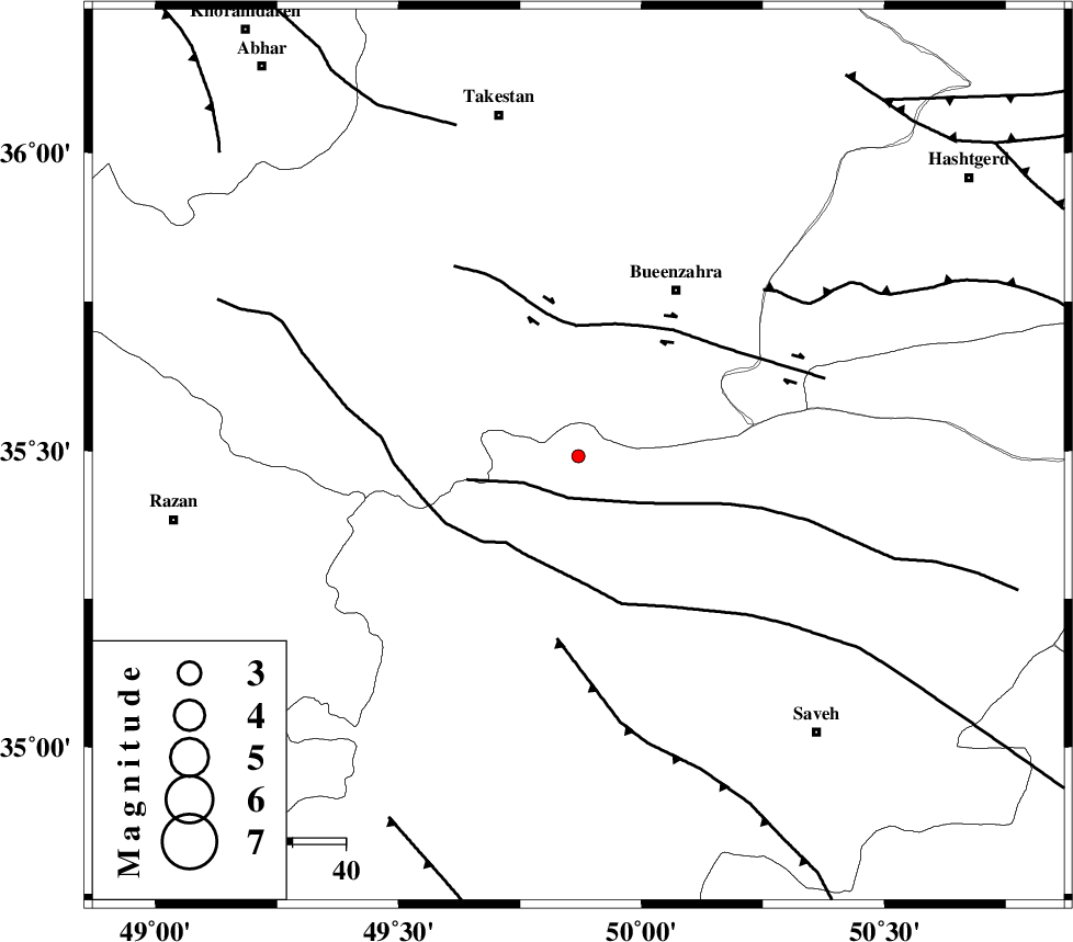
| Location | Lat:35.49 Lon: 49.87 |
| Region | Markazi Province, 36 km South-West of Buinzara |
Nearest Cities |
|
| 11 km North of Duzaj, Markazi Province | |
| 19 km North of Razegian, Markazi Province | |
| 31 km South of Sagezabad, Ghazvin Province | |
| 35 km South East of Danesfahan, Ghazvin Province | |
| 36 km South West of Buinzara, Ghazvin Province | |
| Depth | 14 km |
| Agency | |
Faults within 150 km: |
|
| S_PARANDAK_F (Length: 116 km) , Distance to epicenter: 8 km | |
| KUSHK_E_NOSRAT_F (Length: 230 km) , Distance to epicenter: 21 km | |
| IPAK_F (Length: 80 km) , Distance to epicenter: 24 km | |
| Number of Phases | 6 |
| RMS | 0.1 |
| Number of Stations | 4 |
| Error in Latitude | >2.6 km |
| Error in Longitude | 4.9 km |
| Error in Depth | 14.4 km |
Download waveform in seisan format
to download seisan software Click here
to access information about IIEES stations Click here
Amplitude | ||||||||
| UID | Agency | Station | Component | Amplitude | Period | Arrival Time | Proccessing Time | Signal Clip |
| 93668 | IIEES | ASAO | N | 16.8 | 0.17 | 2014-09-23 09:59:45 | 2014-09-23 12:10:00 | n |
| 93669 | IIEES | CHTH | E | 16.4 | 0.22 | 2014-09-23 09:59:49 | 2014-09-23 12:10:00 | n |
| 93670 | IIEES | GHVR | N | 6.9 | 0.23 | 2014-09-23 10:00:05 | 2014-09-23 12:10:00 | n |
| 93671 | IIEES | GHVR | E | 13.3 | 0.41 | 2014-09-23 10:00:07 | 2014-09-23 12:10:00 | n |
Phase | ||||||||||||
| Agency | Station | Component | Phase Type | Phase Quality | First Motion | Observed Arrival Time | Time Residual | Loc. Flag | Input Weight | Distance | Azimuth | |
| IIEES | ASAO | Z | Pg | E | 2014-09-23 09:59:32 | 0.02 | y | 106 | 172 | |||
| IIEES | ASAO | E | Sg | E | 2014-09-23 09:59:45 | 0.08 | y | 106 | 172 | |||
| IIEES | CHTH | Z | P | E | 2014-09-23 09:59:34 | 0.05 | y | 122 | 68 | |||
| IIEES | CHTH | E | S | E | 2014-09-23 09:59:49 | 0.02 | y | 122 | 68 | |||
| IIEES | GHVR | Z | Pg | E | 2014-09-23 09:59:41 | -0.13 | y | 168 | 131 | |||
| IIEES | KHMZ | Z | Pg | E | 2014-09-23 09:59:46 | -0.05 | y | 195 | 177 | |||