| Prel. Rep. | Date | Time(UTC) | Time(Local) | Lat. | Lon. | Depth | Mag. | Region | Waveform |
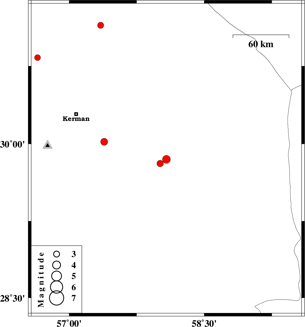
| 2020/11/10 | 21:28:57.9 | 00:58:57.9 | 29.85 | 58.08 | 10 | ML:3.9 | Kerman Province, 87 km North-West of Bam | ||
| 2020/11/10 | 06:49:15.6 | 10:19:15.6 | 29.81 | 58.01 | 15 | ML:3.2 | Kerman Province, 85 km North-West of Bam | ||
| 2020/11/06 | 21:55:05.6 | 01:25:05.6 | 30.83 | 56.65 | 10 | ML:3 | Kerman Province, 8 km of Zarand | ||
| 2020/11/04 | 06:18:43.0 | 09:48:43.0 | 28.77 | 56.83 | 26 | ML:3.9 | Kerman Province, 56 km South-East of Baft | ||
| 2020/11/03 | 19:38:23.8 | 23:08:23.8 | 30.02 | 57.39 | 10 | ML:3.5 | Kerman Province, 42 km South-East of Kerman | ||
| 2020/11/03 | 02:02:28.4 | 05:32:28.4 | 31.14 | 57.35 | 10 | ML:3.1 | Kerman Province, 53 km South-East of Ravar |