| Prel. Rep. | Date | Time(UTC) | Time(Local) | Lat. | Lon. | Depth | Mag. | Region | Waveform |
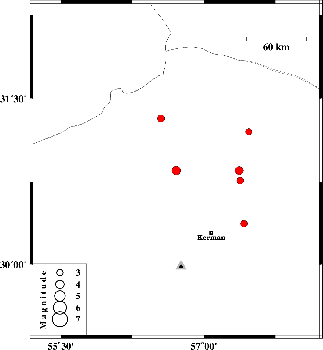
| 2020/12/24 | 11:38:28.8 | 15:08:28.8 | 30.85 | 56.71 | 10 | ML:4.1 | Kerman Province, 14 km -East of Zarand | ||
| 2020/12/12 | 06:28:32.0 | 09:58:32.0 | 31.32 | 56.55 | 10 | ML:3.4 | Kerman Province, 26 km -West of Ravar | ||
| 2020/11/29 | 01:23:10.4 | 04:53:10.4 | 30.37 | 57.42 | 10 | ML:3.3 | Kerman Province, 34 km -East of Kerman | ||
| 2020/11/27 | 04:13:28.7 | 07:43:28.7 | 30.76 | 57.38 | 10 | ML:3.2 | Kerman Province, 60 km North-East of Kerman | ||
| 2020/11/26 | 09:41:52.0 | 13:11:52.0 | 31.2 | 57.47 | 10 | ML:3 | Kerman Province, 63 km -East of Ravar | ||
| 2020/11/25 | 21:47:52.3 | 01:17:52.3 | 30.85 | 57.37 | 10 | ML:3.8 | Kerman Province, 77 km -East of Zarand |