| Prel. Rep. | Date | Time(UTC) | Time(Local) | Lat. | Lon. | Depth | Mag. | Region | Waveform |
|
|
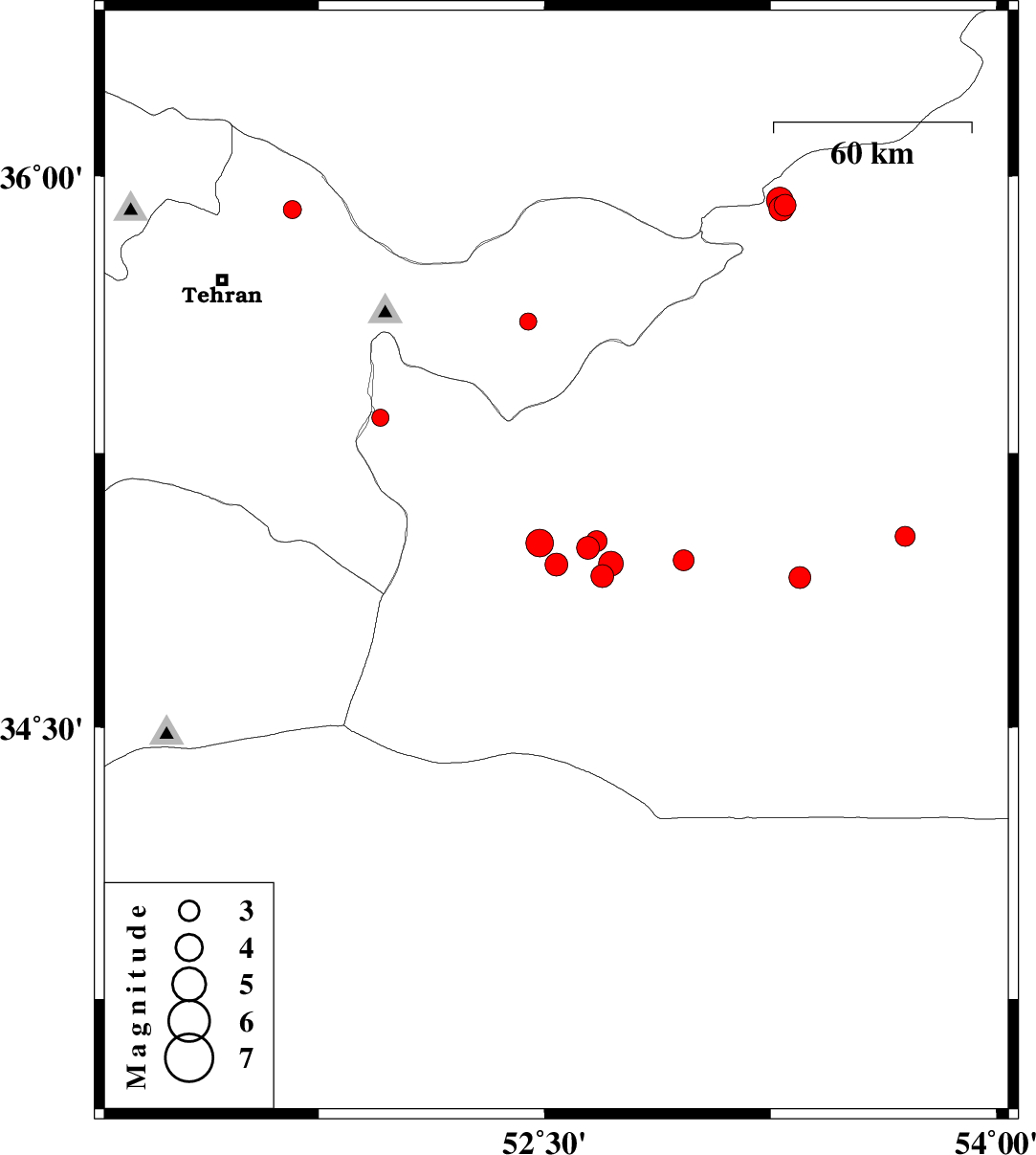
2023/01/10
|
21:25:47.4
|
00:55:47.4
| 35.91 | 51.663 | 12 |
ML:2.7
|
Tehran Province, 23 km North-East of Tajrish | |
|
|
2023/01/10
|
15:50:08.1
|
19:20:08.1
| 34.946 | 52.539 | 12 |
ML:3.4
|
Semnan Province, 35 km South-East of Garmsar | |
|
|
2023/01/09
|
08:21:28.8
|
11:51:28.8
| 35.004 | 52.484 | 10 |
ML:4.1
|
Semnan Province, 27 km South-East of Garmsar | |
|
|
2023/01/07
|
08:04:45.7
|
11:34:45.7
| 35.922 | 53.298 | 9 |
ML:3.2
|
Semnan Province, 30 km South-East of Pol-E-Sefid | |
|
|
2023/01/07
|
04:58:05.7
|
08:28:05.7
| 35.912 | 53.285 | 9 |
ML:3.7
|
Semnan Province, 30 km South-East of Pol-E-Sefid | |
|
|
2023/01/07
|
02:41:06.2
|
06:11:06.2
| 35.934 | 53.28 | 12 |
ML:3.9
|
Semnan Province, 28 km South-East of Pol-E-Sefid | |
|
|
2023/01/06
|
02:35:13.9
|
06:05:13.9
| 35.607 | 52.445 | 8 |
ML:2.6
|
Tehran Province, 33 km South-West of Firuzkuh | |
|
|
2023/01/02
|
08:48:56.5
|
12:18:56.5
| 35.346 | 51.955 | 10 |
ML:2.6
|
Semnan Province, 26 km -East of Varamin | |
|
|
2022/12/26
|
02:25:22.1
|
05:55:22.1
| 34.957 | 52.962 | 12 |
ML:3.1
|
Semnan Province, 64 km South-East of Garmsar | |
|
|
2022/12/24
|
18:17:28.9
|
21:47:28.9
| 34.911 | 53.347 | 12 |
ML:3.2
|
Semnan Province, 73 km South of Semnan | |
|
|
2022/12/20
|
20:46:40.5
|
00:16:40.5
| 35.023 | 53.697 | 7 |
ML:3
|
Semnan Province, 66 km South-East of Semnan | |
|
|
2022/12/16
|
06:34:44.1
|
10:04:44.1
| 34.915 | 52.691 | 17 |
ML:3.4
|
Semnan Province, 46 km South-East of Garmsar | |
|
|
2022/12/16
|
01:57:29.7
|
05:27:29.7
| 34.992 | 52.644 | 12 |
ML:3.4
|
Semnan Province, 37 km South-East of Garmsar | |
|
|
2022/12/16
|
01:49:48.5
|
05:19:48.5
| 35.01 | 52.672 | 12 |
ML:3.1
|
Semnan Province, 38 km South-East of Garmsar | |
|
|
2022/12/16
|
01:41:01.9
|
05:11:01.9
| 34.948 | 52.72 | 12 |
ML:3.7
|
Semnan Province, 46 km South-East of Garmsar | |