| Prel. Rep. | Date | Time(UTC) | Time(Local) | Lat. | Lon. | Depth | Mag. | Region | Waveform |
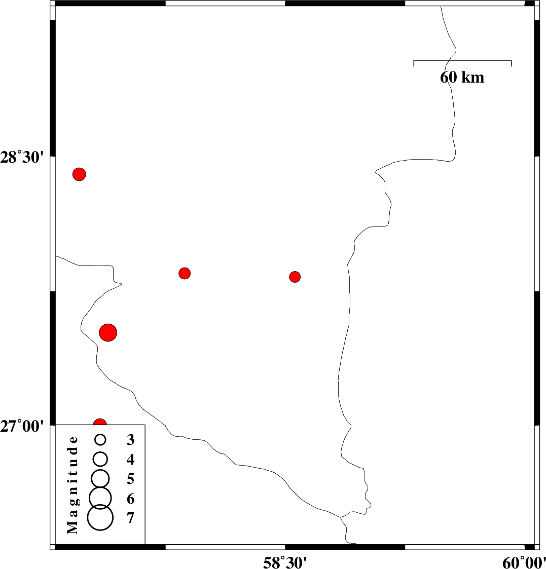
| 2014/08/16 | 07:42:23.5 | 12:12:23.5 | 27.83 | 58.56 | 15 | ML:3.1 | Kerman Province, 86 km South-East of Kahnuj | ||
| 2014/08/06 | 15:55:32.8 | 20:25:32.8 | 28.4 | 57.21 | 29 | ML:3.6 | Kerman Province, 59 km South-West of Jiroft | ||
| 2014/07/30 | 07:46:13.7 | 12:16:13.7 | 27.85 | 57.87 | 16 | ML:3.3 | Kerman Province, 20 km South-East of Kahnuj | ||
| 2014/07/26 | 10:48:41.2 | 15:18:41.2 | 27 | 57.34 | 42 | ML:3.8 | Hormozgan Province, 31 km South-East of Minab | ||
| 2014/07/22 | 15:22:42.8 | 19:52:42.8 | 27.52 | 57.39 | 25 | ML:5 | Kerman Province, 16 km North-West of Manujan |