| Prel. Rep. | Date | Time(UTC) | Time(Local) | Lat. | Lon. | Depth | Mag. | Region | Waveform |
|
|
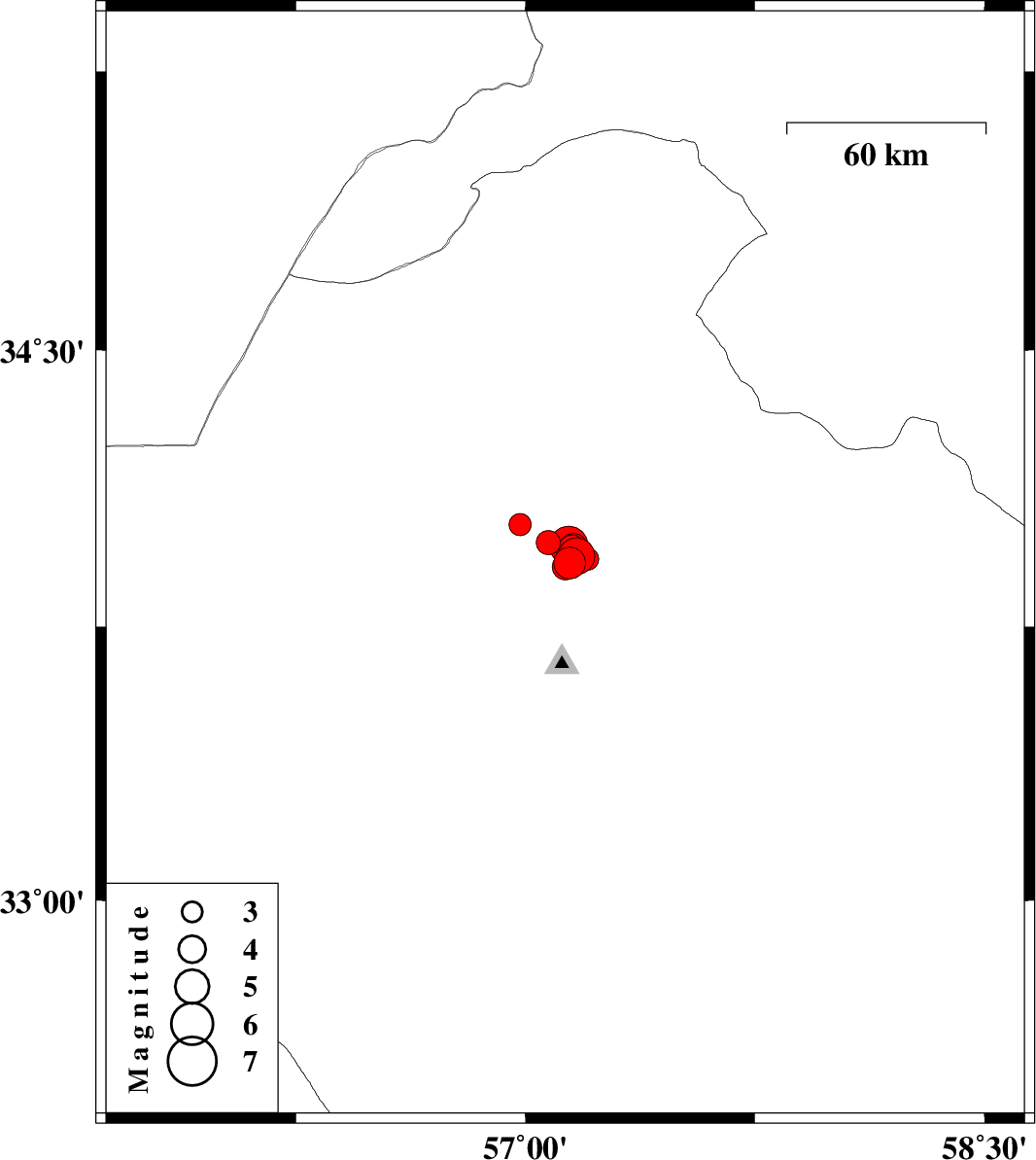
2022/12/25
|
17:49:56.1
|
21:19:56.1
| 33.923 | 57.145 | 9 |
ML:4.6
|
Khorasan(center) Province, 41 km North-East of Tabas | |
|
|
2022/12/25
|
12:06:07.8
|
15:36:07.8
| 33.913 | 57.13 | 10 |
ML:3.8
|
Khorasan(center) Province, 40 km North-East of Tabas | |
|
|
2022/12/24
|
23:08:39.8
|
02:38:39.8
| 33.978 | 57.074 | 12 |
ML:3.5
|
Khorasan(center) Province, 44 km North-East of Tabas | |
|
|
2022/12/24
|
20:22:45.8
|
23:52:45.8
| 34.027 | 56.983 | 12 |
ML:3.2
|
Yazd Province, 48 km North of Tabas | |
|
|
2022/12/24
|
13:24:37.3
|
16:54:37.3
| 33.941 | 57.166 | 10 |
ML:5.4
|
Khorasan(center) Province, 44 km North-East of Tabas | |
|
|
2022/12/24
|
06:48:19.5
|
10:18:19.5
| 33.916 | 57.142 | 12 |
ML:3.6
|
Khorasan(center) Province, 41 km North-East of Tabas | |
|
|
2022/12/21
|
16:30:39.6
|
20:00:39.6
| 33.963 | 57.152 | 12 |
ML:4
|
Khorasan(center) Province, 46 km North-East of Tabas | |
|
|
2022/12/21
|
01:02:10.6
|
04:32:10.6
| 33.955 | 57.14 | 8 |
ML:3.4
|
Khorasan(center) Province, 44 km North-East of Tabas | |
|
|
2022/12/17
|
20:52:12.1
|
00:22:12.1
| 33.933 | 57.204 | 10 |
ML:3.3
|
Khorasan(center) Province, 45 km North-East of Tabas | |
|
|
2022/12/13
|
14:58:36.4
|
18:28:36.4
| 33.965 | 57.157 | 9 |
ML:4.1
|
Khorasan(center) Province, 46 km North-East of Tabas | |
|
|
2022/12/13
|
14:14:26.2
|
17:44:26.2
| 33.971 | 57.141 | 10 |
ML:5.6
|
Khorasan(center) Province, 46 km North-East of Tabas | |