| Prel. Rep. | Date | Time(UTC) | Time(Local) | Lat. | Lon. | Depth | Mag. | Region | Waveform |
|
|
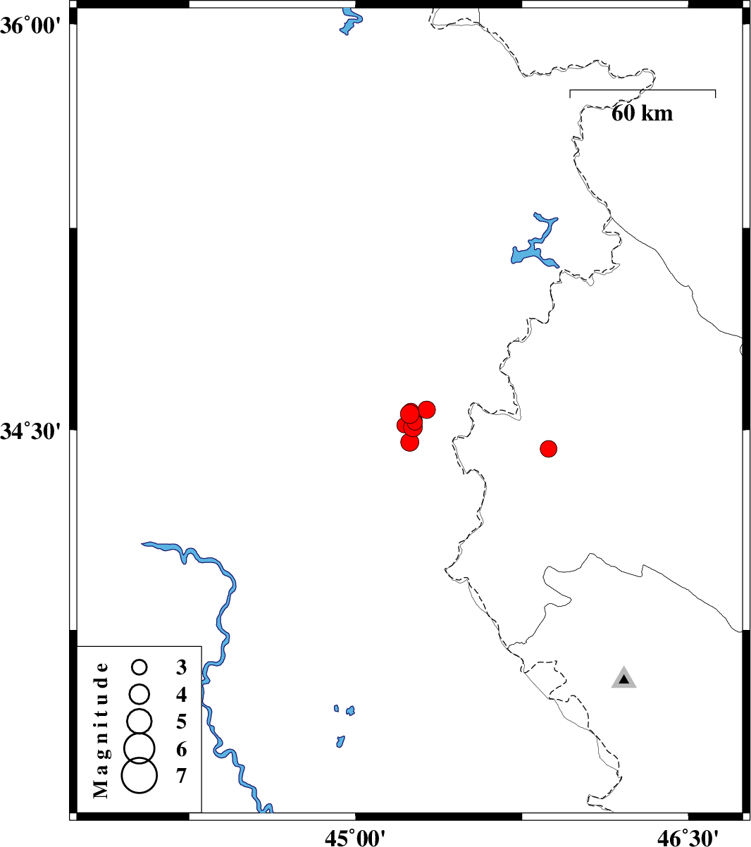
2021/07/31
|
23:41:23.7
|
04:11:23.7
| 34.559 | 45.244 | 12 |
ML:3.8
|
Iraq, 31 km -West of Qasr-E-Shirin | |
|
|
2021/07/31
|
17:32:02.6
|
22:02:02.6
| 34.528 | 45.266 | 12 |
ML:3.1
|
Iraq, 29 km -West of Qasr-E-Shirin | |
|
|
2021/07/31
|
15:01:45.1
|
19:31:45.1
| 34.509 | 45.259 | 12 |
ML:3.8
|
Iraq, 30 km -West of Qasr-E-Shirin | |
|
|
2021/07/31
|
14:25:23.4
|
18:55:23.4
| 34.517 | 45.22 | 12 |
ML:3.1
|
Iraq, 33 km -West of Qasr-E-Shirin | |
|
|
2021/07/31
|
14:22:49.0
|
18:52:49.0
| 34.536 | 45.265 | 12 |
ML:3.1
|
Iraq, 29 km -West of Qasr-E-Shirin | |
|
|
2021/07/31
|
14:19:31.7
|
18:49:31.7
| 34.569 | 45.249 | 16 |
ML:3.2
|
Iraq, 31 km -West of Qasr-E-Shirin | |
|
|
2021/07/31
|
14:14:40.6
|
18:44:40.6
| 34.454 | 45.244 | 12 |
ML:3.7
|
Iraq, 32 km -West of Qasr-E-Shirin | |
|
|
2021/07/31
|
14:08:39.7
|
18:38:39.7
| 34.575 | 45.32 | 20 |
ML:3.5
|
Iraq, 25 km -West of Qasr-E-Shirin | |
|
|
2021/07/31
|
14:02:43.0
|
18:32:43.0
| 34.538 | 45.261 | 12 |
ML:3.4
|
Iraq, 30 km -West of Qasr-E-Shirin | |
|
|
2021/07/26
|
21:11:26.0
|
01:41:26.0
| 34.429 | 45.87 | 12 |
ML:3.4
|
Kermanshah Province, 4 km of Sar-e pol-e zahab | |